|
|
Toa Baja
Toa Baja is a municipality on the North Coast of Puerto Rico to the West of the San Juan Metropolitan Area. The municipality is known as Cuidad Llanera (or City of Flatlands) due to is low lying and flat topography, which has historically made flooding a problem from its earliest beginnings right up to the present day, as experienced in the aftermath of hurricanes Irma and Maria in 2017.
|
|
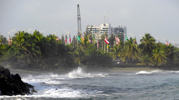
Welcome to Toa Baja.
|
The town (and its sister town to the South, Toa Alta) take their names from the Taíno word "toa" meaning "mother" and was the name the Taíno people gave to the river running through the region, today known as Río de la Plata. During the early Spanish colonial period the area was established as La Granja del Rey (The King's Farm) and used for experimentation in the growing of European and local crops to find out what was best suited to the area. The earliest settlers were primarily from the Canary Islands, and the region continued to develop for farming because of the rich alluvial soil around the river.
Known early on as La Ribera del Toa (The Toa Riverbank), Toa Baja eventually became a municipality in 1745 on the authority of Matías de Abadía, governor of Puerto Rico. The parish church, known today under the name of San Pedro Apóstol (Saint Peter the Apostle), was established in 1749. By 1779 a chapel was also consecrated on the plantation of Hacienda Plantaje which in 1839, when the municipality of Trinidad de Palo Seco was founded, became the center of worship for the people of that town.
Toa Baja suffered frequently from flooding of the river which led in 1841 to a group of residents suggesting that the town be moved to the higher ground to the North. This suggestion was rejected by the majority of the populace, however the following year the municipality of Dorado was founded in that area. The frequent problems with flooding may have been why both Dorado to the North and Toa Alta to the South, both of which have higher ground, saw frequent migrations of people from Toa Baja. Despite these setbacks, Toa Baja saw a growth in the cultivation of sugar cane due to its fertile land and by the late 19th century was a significant producer of this crop.
Along with several other municipalities in Puerto Rico, in 1902 Toa Baja lost its independence, due to the Municipality Consolidation Law, and was incorporated as part of the municipality of Bayamón. This political decision in the insular legislature was reversed in 1905 and Toa Baja was again restored as its own municipality.
During the 20th century Toa Baja maintained a significant place in agricultural production with its sugar cane which saw production continue late into that century. Toa Baja has slowly transitioned its economy into other areas, as well as growing in population with the development of housing, and becoming a significant "dormitory" town for the San Juan Metropolitan area.
|
Fortín San Juan de la Cruz (El Cañuelo)
|
|
Fortín San Juan de la Cruz seen from inside San Juan Bay
|
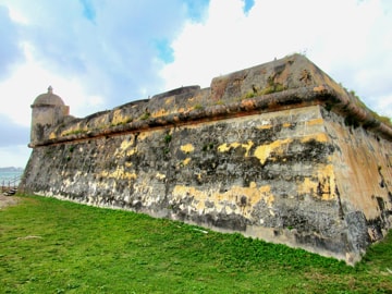
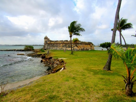
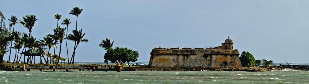
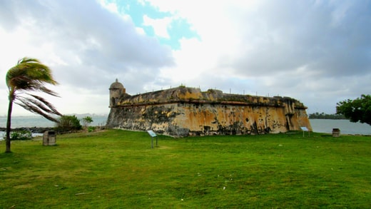
Located at the western entrance to San Juan Bay, Fortín San Juan de la Cruz (Fort of San Juan of the Cross) known by the nickname El Cañuelo, was built during Spanish colonial times to aid in guarding the entrance to the Bay by providing crossfire in conjunction with the main fortifications of Castillo Felipe del Morro (El Morro) on the San Juan side. It also provided protection to the mouth of the Bayamón River which entered San Juan Bay close by and was crucial at that time as a main transportation route between San Juan and the interior of the Island.
|
|
The Fort showing "El Morro", through the trees, on the other side of the Bay entrance
|
Any unfriendly ship trying to enter San Juan Bay would probably try to stay as far from El Morro as possible, but then ran the risk of grounding in the shallow waters near El Cañuelo and becoming easy prey to its cannon. By the early 19th century, El Morro's batteries of cannon had been upgraded and were powerful enough to command a distance far greater than that to El Cañuelo which therefore became obsolete.
As it was no longer needed for military purposes, in the early 1800s El Cañuelo was refurbished with sleeping quarters and a kitchen to make it available to quarantine patients with leprosy and cholera which had become a problem in San Juan. There is no evidence, however, that it was ever used for this purpose. Despite it no longer being manned, in 1898 when the US Navy bombarded San Juan, they fired upon El Cañuelo as well as El Morro.
|
|
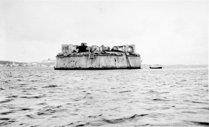
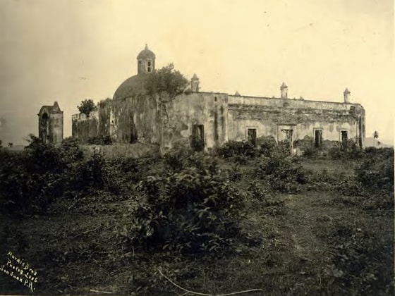
El Cañuelo in 1935Photo Source: Library of Congress
|
Originally built of wood between 1608 and 1610, El Cañuelo was replaced my a more substantial masonry structure after being burned by Dutch attackers in 1625. The fort was located on a small rocky islet and was completely surrounded by water, as can be seen in the 1935 photo shown here. This photo was taken during an assessment of work needed to refurbish El Cañuelo.
|
|
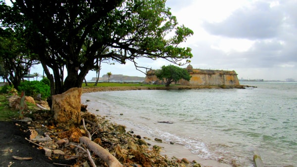
El Cañuelo firmly attached to land today
|
In 1943 the US Corp. of Engineers dredged the entrance to San Juan Bay to allow entry to large US warships and submarines. The material that was dredged up from the Bay was used to fill in the area around the islet and join it to the larger Isla de Cabras (Goat Island) to its North and to Palo Seco to its South, with the result that today one can drive from Palo Seco across a short causeway and reach El Cañuelo and Isla de Cabras without getting wet.
|
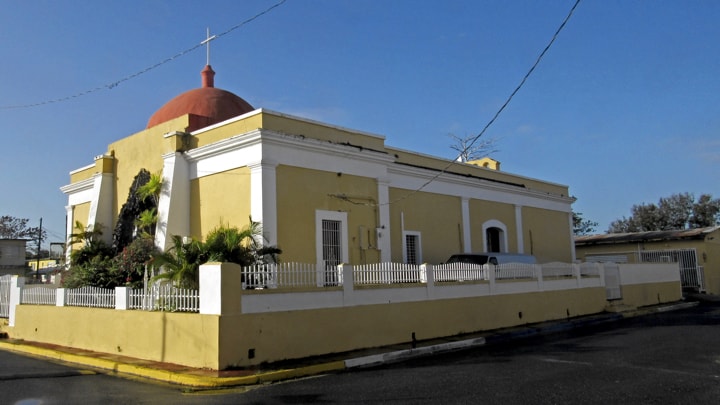
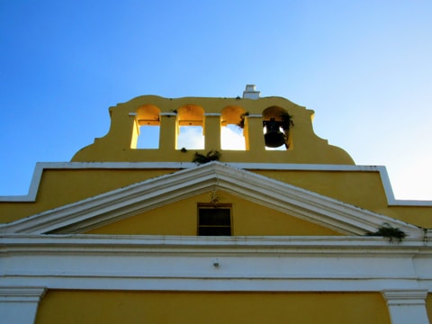
Parroquia San Pedro Apóstol
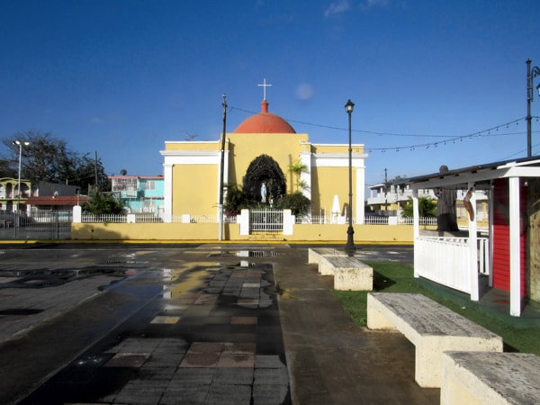
The existing building of Parroquia San Pedro Apóstol (Parish Church of Saint Peter the Apostle), was constructed in the 18th century, though an earlier chapel on the site is mentioned in records as far back as the early 16th century. While there remains no sign of the original chapel, its existence makes sense given the early occupation of this area in Puerto Rico by Spanish colonists. The current church building was dedicated in 1749, shortly after Toa Baja became a municipality, and was originally dedicated as Nuestra Señora de la Concepción, San Pedro and San Matías. Though the existing build only dates from around the mid-18th century, it is one of the oldest churches in Puerto Rico.
|
|
Parroquia San Pedro Apóstol
|
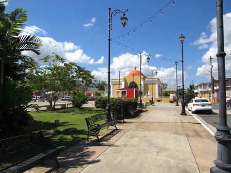
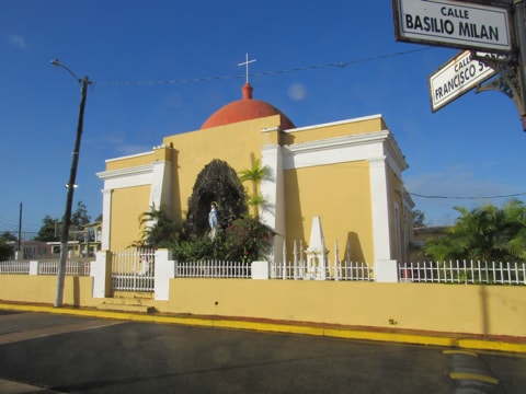
The church presents an unusual aspect in terms of its position in the town's plaza de recreo in that it is the back of the church which shows itself to the plaza. This can be understood, given that the church is properly oriented and, as it sits on the West side of the plaza, it is the East end of the church where the altar rests that must point this way. The church's façade faces towards the river and town tradition says that originally the plaza de recreo was on the other side of the church along with the surrounding town where one would expect it.
|
|
San Pedro Apóstol showing its back to the Plaza
|
Residents decided, however, to move away from the river and built a new plaza on slightly higher ground to the East while the church remained in its place. Given the history of problems with flooding in Toa Baja, this bears the sound of truth. In the town's current layout, very little sits closer to the river than the church. Despite its unusual positioning, the church presents itself well when viewed from the plaza.
|
|
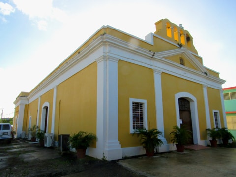
San Pedro Apóstol façade
|
The church building's layout is a straightforward, rectangular plan with three naves and a presbytery covered by a dome without lantern or tambour. A simple façade is crowned with a belfry, which lacks all the bells it may once have had, but which continues to provide character.
|
|
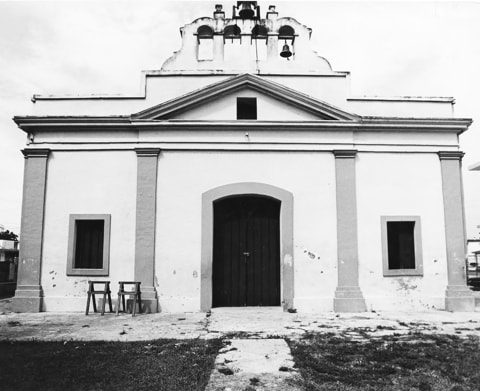
Façade & belfry in 1975Photo Source: National Register of Historic Places
|
|
|
|
The church's belfry
|
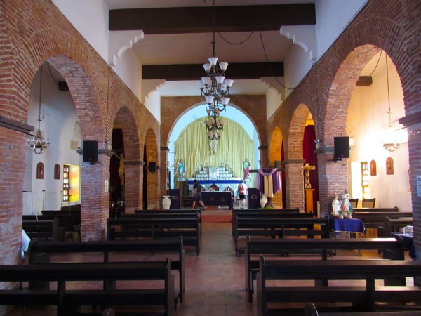
|
Behind the altar, the church houses a magnificent silver antependium and other silver ornaments. These are mentioned as part of the church as far back as 1775 when, on his travels, Benedictine monk Fray Íñigo Abbad y Lasierra visited Toa Baja and later, in his book, "Historia geográfica, civil y natural de la isla de San Juan Bautista de Puerto Rico" (Geographic, civil and natural history of the island of Saint John the Baptist of Puerto Rico) he remarked, "La iglesia de Toa-baja es decente y la mas bien alhajada de toda la isla" (The Toa-baja church is decent and the most well-appointed on the entire Island).
|
|
San Pedro Apóstol interior
|
|
|
|
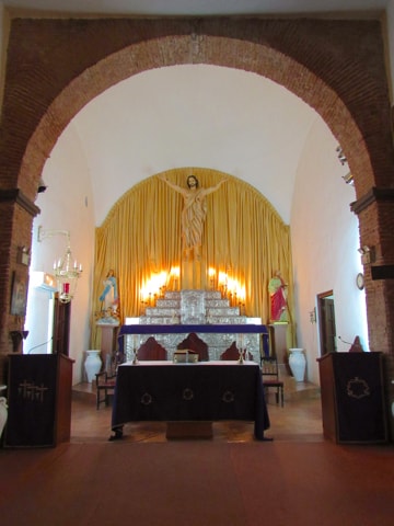
Interior showing altar & silver antependium
|
|
|
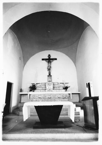
Altar and antependium in 1975Photo Source: National Register of Historic Places
|
During the 20th century the church was abandoned at one point for about 18 years, without a priest or maintenance. During that time, the town's people removed and guarded the treasures of the church, only returning them once a priest was again appointed. The pictures shown here from 1975 were taken during an inventory of the church as part of the process of requesting its inclusion in the National Register of Historic Places. The application was justifiably accepted, and its current state shows it has been well cared for since then.
|
|
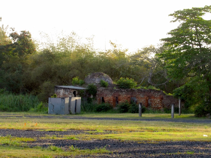
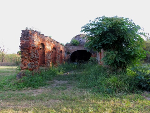
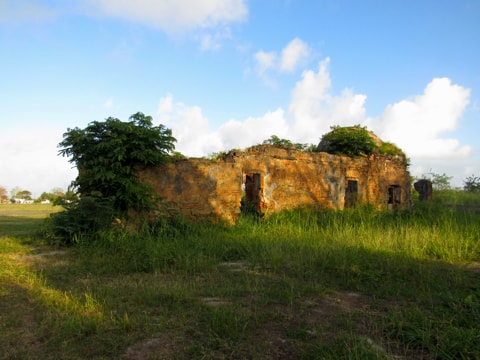
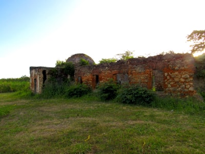
La Ermita Nuestra Señora de la Candelaria del Plantaje
La Ermita Nuestra Señora de la Candelaria del Plantaje (The Chapel of Our Lady of Candelaria of the Plantaje), was built in the 18th century as a chapel to serve the people who lived and worked on the plantation of Hacienda Plantaje.
|
|
Ruins of La Ermita Nuestra Señora de la Candelaria del Plantaje
|
Today, what is left of the chapel are ruins, sitting on an area of undeveloped land in Barrio Sabana Seca near the northeastern border of Toa Baja where it follows the old course of the Bayamón River (prior to is canalisation).
In its current state of ruin, the chapel has lost its doors, windows and roof, which were all made of wood. The lantern which topped the dome and the chapel's southern façade are also gone, but the ruins still convey a good sense of the building with its single nave crossed by a transept and crowned with a dome at the intersection.
|
|
Looking in from the South through the missing façade
|
The plantation of Hacienda Plantaje was established by Miguel Enríquez. Son of a freed slave, Enríquez made a fortune as a privateer in the early 18th century, becoming one of the richest men in Puerto Rico at the time. He used his wealth to acquire the land which he developed as a sugar plantation and on which he built a manor house named Plantaje (which means Broad-Leafed Plantain in English, and from which the planation took its name). The construction of the chapel, close to the residence, followed shortly after that and it became the place of worship for Enríquez and his friends as well as the workers and slaves on the plantation.
|
|
Viewed from the East side
|
Enríquez's descent from slaves and his wealth created a number of enemies who worked against him, painting many of his activities as a privateer as illegal, and his properties were finally forfeit to the Spanish Crown in 1735. While everything was actioned off, Hacienda Plantaje remained intact and grew and prospered as a sugar plantation, under various owners, into the late 19th century.
While already serving as a place of worship, La Ermita was formally consecrated in 1779 and the adoption of Nuestra Señora de la Candelaria as its patron probably reflects the heritage of people in Toa Baja as this is also the patron saint of the Canary Islands, from where many early residents of the municpality came.
|
|
Looking at the West side
|
In 1796, La Ermita was the first stop on a pastoral visit by Juan Bautista Zengotita, the Bishop of San Juan. During the visit the bishop inspected the chapel, its religious items and its registers of baptisms, marriages, and burials. Of particular note, recorded into the chapel's books, are the bishop's instructions to the chaplain that sacraments could only be given to the people from or related to the plantation. This is most likely due to the fact that a chapel which is part of a plantation would need to be paid for, in all its expenses, by the plantation and not the Church or Spanish Government. Despite these instructions from the bishop, it is known that in the 19th century La Ermita had become the place of worship for much of the local community. It remained so until it was deconsecrated in 1893 when Nuestra Senora del Carmen was founded as the parish church for Cataño and Palo Seco, and the Catholic Church stopped appointing chaplains to La Ermita.
|
|
La Ermita c.1910
|
Photo Source: National Register of Historic Places
|
While it is not clear from records, the planation seems to have declined at this time and by the first decades of the 1900s had been sold. The area around La Ermita became a dairy farm through much of the 20th century, and its use as such caused most of the damage it then suffered. The photo here, from around 1910, still shows a recognizable structure but already displays strong signs of decay.
Nowadays, the area immediately surrounding La Ermita, while no longer a farm, remains undeveloped. Hacienda Plantaje once stretched across the entire area from the La Plata (Toa) River on the West to the Bayamón River on the East, while today the part of the plantation from the Cocal River to the edge of the land surrounding La Ermita is largely covered by the various sections of the housing development, which dates from the early 1960s, known as Levittown.
|
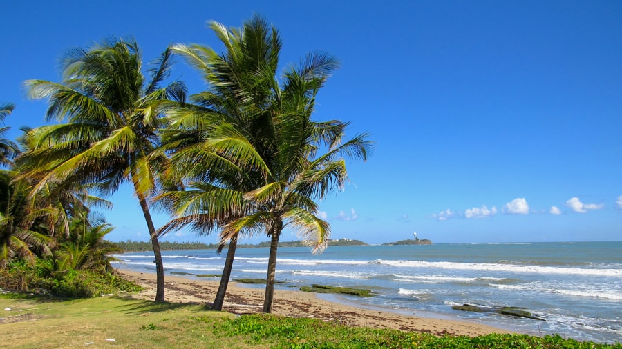
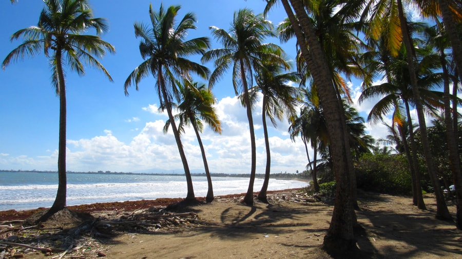
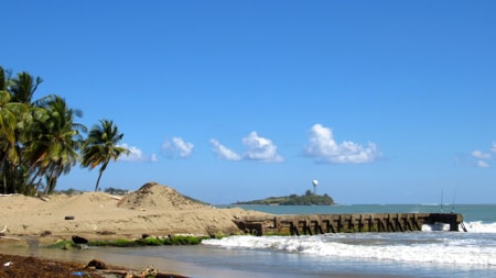
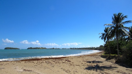
Beaches in Toa Baja
Toa Baja has a very narrow coastal area in its boundaries between Cataño and Dorado, into which it manages to fit a number of beaches.
|
|
Levittown Beach looking towards Punta Salinas
|
|
|
Boca Vieja Beach looking towards Levittown
|
|
|
Looking to Punta Salinas from Boca Vieja Beach
|
|
|
Looking to Punta Salinas from the West, near Río Cocal
|
|
Other scenes from around Toa Baja
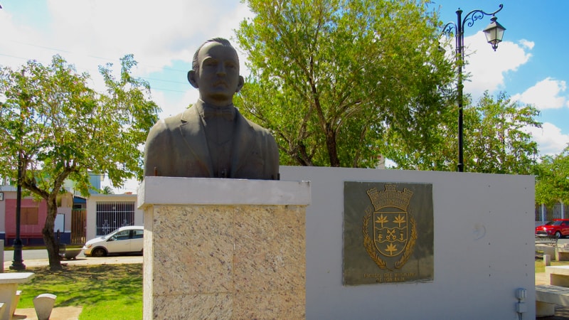
Statue of Virgilio Dávila
|
|
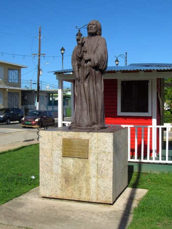
Statue of Virgilio Dávila in the Plaza de Recreo
|
Virgilio Dávila was born in Toa Baja in 1869 and died in Bayamón in 1943.
Reknowned as a poet, educator, politician and businessman, he published his first book of poetry, "Patria", in 1903.
From 1905 to 1910 he served as mayor of Bayamón. He has a school and a housing project named after him as well as statues erected in his honour, in that city.
|
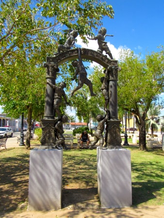
Sculpture in the Plaza de Recreo
|
|
Sculpture in front of the Casa Alcaldía
|
This sculpture in the Plaza de Recreo, close to the Casa Alcaldía, along with grassy areas and irregular trees, give the Plaza a somewhat parklike atmosphere.
|
|
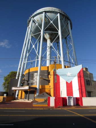
Bandera de Hector en Toa Baja
|
|
Bandera de Hector
|
The water tower in the Levittown area of Barrio Sabana Seca has been a landmark for many years.
The Municipal Library built into the base of the tower, is now also the location of Toa Baja's edition of the "Bandera de Hector" on one of its exterior walls.
|
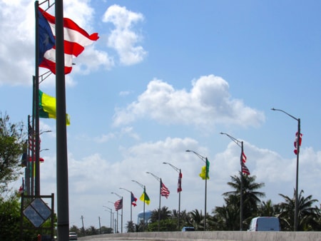
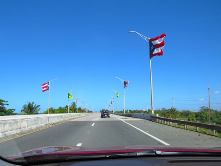
Bridge of flags
The bridge on Road PR-165, that passes over the mouths of Río Bayamón and Río Hondo as they empty into the Atlantic Ocean, is easily recognised by is rows of flags which stretch along its full length, flying in the ocean breezes.
|
Other views around the Plaza de Recreo
|
|
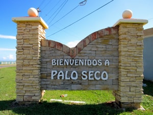
Trinidad de Palo Seco
|
|
Welcome to Palo Seco
|
Until the mid-19th century the main point for marine transport between San Juan and towns West and South of the capital was Palo Seco. Located on a peninsula forming the western side of San Juan Bay, and next to the mouth of the Bayamón River, this was the key point for shipping goods into or out of San Juan. This port handled transfers to ships that would move along the North coast or handled those using the Río Bayamón to connect with inland areas, making Palo Seco well suited to its purpose as a commercial gateway to San Juan.
In the 1830s a group of residents, led by Antonio Choperena and their priest Agustin Valldejuli, petitioned to create a town and in 1839 the municipality of Trinidad de Palo Seco was founded. This however was short lived as the town failed to live up to its commitments to build a parish church, the Casa del Rey (King's House),
|
|
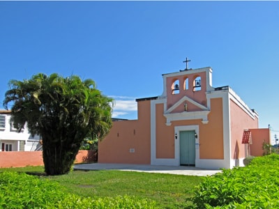
Capilla Nuestra Señora del Carmen
|
a cementery and various other components regularly required of a formal town. The result was that its status as a municipality was revoked in 1845.
In this same time-frame, plans to build a new port in the Cataño area were being developed and beginning to be executed. The more sheltered location of the new port, its ability to handle deeper ships, and its closeness to Bayamón together with greater room for expansion, led to it becoming the preferred location for transportation and commerce.
Palo Seco remains today as a small community on the peninsula, with its church as the sole reminder of its short history as a municipality, and being passed through by people on their way to the beaches on Isla de Cabras.
|
|
|