|
|
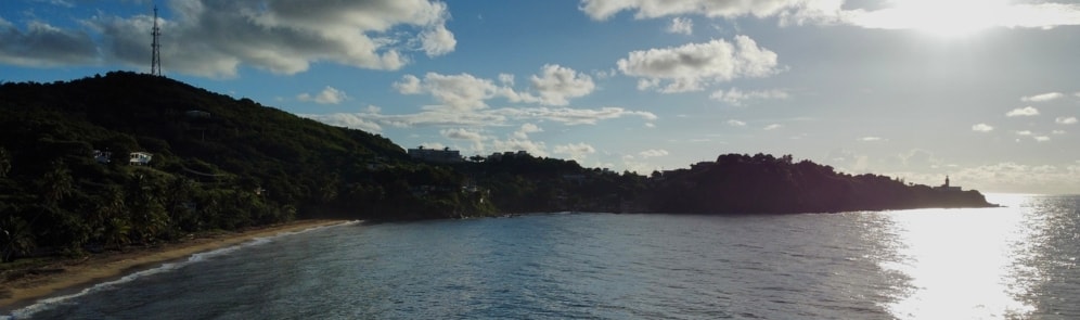
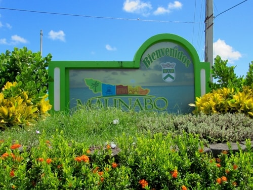
Maunabo
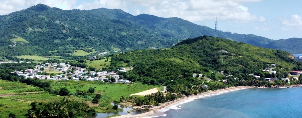
Maunabo is a small town located at the southeast corner of Puerto Rico where it transitions from South Coast to East Coast. The area began to be populated once Tainos left and government action drove off the pirates, privateers and smugglers who harassed the region.
|
|
Welcome to Maunabo
|
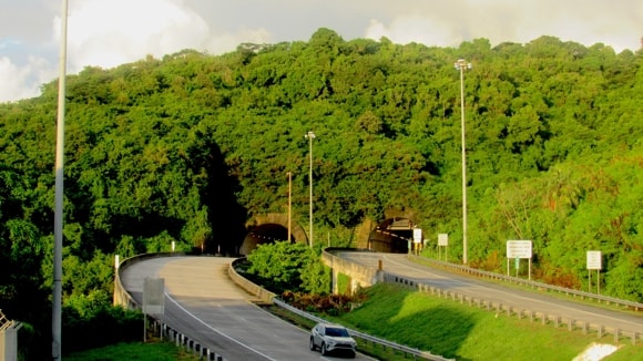
It is surrounded by mountains which run all the way to the coast on both the southern and eastern sides. More recently, the Maunabo Tunnels have made access easier from the North as they run through the mountain in place of the slow twisting roads that go over. On its northern side it is bordered by Yabucoa and on its western side by Patillas.
Many maintain that the name of this municipality comes from the Taino word Manatuabón, which was the name of the main river that irrigates the area, while others argue that the origin of its name is related to the Taino cacique (chief) of the region. What is more certain is that the first people to settle in the area where residents from Guayama who gradually moved along the coast as the region became safer.
While the historian, Calletano Coll y Toste claimed 1779 as the year in which Maunabo was founded as a municipality, it is more generally accepted that this occurred in 1799. The latter date bears a closer relation to the establishment of the parish church of San Isidro Labrador y Santa María de la Cabeza and it was during the early years of the 19th century that the main municipal building works occurred, with the Casa del Rey (King's House / Town Hall) being completed in 1825.
|
|
Maunabo Tunnels
|
In this period a port was constructed on the East coast in the Emajagua area, which encouraged trade and expansion of the town's economy.
During the 19th century the population of Maunabo continued to grow and with it the shipping in the area also expanded. By the start of the last decade of the century Punta Tuna peninsula at the southeast corner of the island was selected to erect a lighthouse to aid in navigation around the island, and this was in place by 1893.
All the advances in the town suffered a serious reversal in 1899 when hurricane San Ciriaco struck the island with devastating effect. With the hurricane's entry point in the southeast of the island, Maunabo suffered the loss of almost every house in the town. The hurricane destroyed the sugar cane mills in the major haciendas which were, at that time, a major source of employment and mainstay of the economy in the town.
In 1902, as with a number of municipalities around the island subject to a law to consolidate towns, Maunabo became part of Yabucoa. The law was repealed in 1905 and Maunbo was returned to its previous state and has remained its own municipality ever since.
|
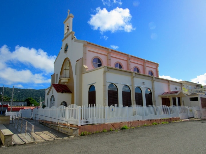
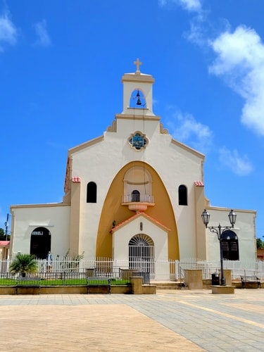
San Isidro Labrador y Santa María de la Cabeza Parish Church
As with most towns during Spanish colonial times, the establishment of the parish church went hand in hand with the founding of the municipality. In the case of Maunabo there is some disagreement as to the date of the town's founding and with little in the way a formal records having been preserved by either the municipality or the parish, dates need to be inferred from what sources are available.
|
|
Parroquia San Isidro Labrador y Santa María de la Cabeza
|
While historian Cayetano Coll y Toste claimed 1779 as the founding of Maunabo, this is contradicted by other sources. In particular, Pedro Tomás de Córdova in his book "Geographical, Historical, Economic and Statistical Memories of the Island of Puerto Rico" (1831) states -
"This town is situated on the East coast of the island, a league inland. It is bordered on the N. by Yabucoa, and on the S. and W. by Patillas. It is three quarters of a league in length N. S. and two leagues E. W. It was founded in 1799."
Further, in relation to the church he writes -
"The church was erected in 1799 under the patronage of San Isidro y Sta. María de la Cabeza. It has its own priest, sexton and majordomo. The funds of this in 1830 were 56 pesos 2 reales and the value of their ornaments 478."
|
|
Façade of San Isidro Labrador
|
|
|
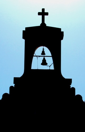
Silouhetted against the early morning sun
|
As Córdova had been Secretary to the Captain-General of Puerto Rico his statements carry weight, and it is generally accepted that the parish church was established in 1799 and that the founding of the municipality corresponds to that same time. That date is further reinforced by Don Ramón de Castro y Gutiérrez, who as Captain-General of Puerto Rico from 1795 to 1804, recorded that the town was founded separately from Yabucoa during his tenure.
Additional mention with regard to the church in Maunabo occurs in 1858 when Fray Benigno Carrión, Bishop of Puerto Rico writes to Queen Isabella in a report on the state of churches in Puerto Rico -
"The number of parish churches on this island being 73, there are amongst them those which were and are still totally ruined; those being the churches of Vega Baja, Cidra, Utuado, Maunabo and Guayama. These have for years been using private houses for parish service and other acts of worship, despite these being parishes of the most important and populous on this island."
|
|
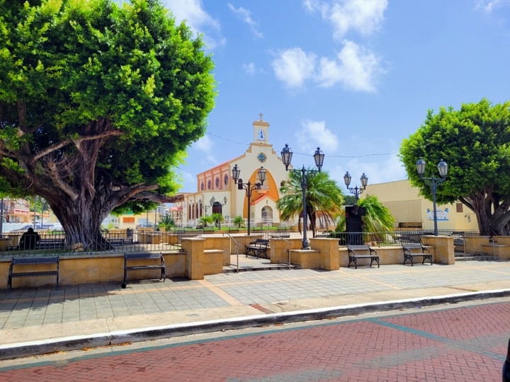
Viewed from across the Plaza de Recreo
|
The state of the Maunabo church got even worse as indicated in the Ecclesiastical Bulletin of 1868, which records that the church, then built of wood, was totally destroyed by hurricane San Narciso.
Sometime later, the church would be rebuilt in masonry, but the "Ecclesiastical Bulletin" of 1899 tells us that the temple was affected by hurricane San Ciriaco, as was the whole of Maunabo.
The next mention of San Isidro Labrador is in 1928 when it is known to have been destroyed by hurricane San Felipe. During the 1930s a new church was built by architect Fransisco Porrata of Ponce, and it is that church which survives today as the core of the current building.
|
|
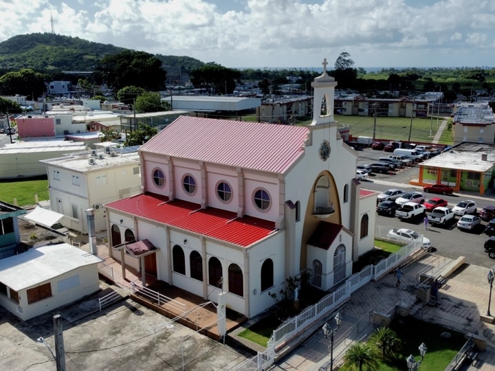
San Isidro Labrador located on the East side of the Plaza
|
Still, the church received major alterations when a refurbishing project was carried out from 1978 to 1979, though it came close to being replaced yet again.
The congregation of the church were given the choices of demolishing the existing structure and replacing it with a modern concrete one, or refurbishing and expanding the existing building. They chose the latter and by March 1979 the project was finished with major additions being new lateral aisles added to expand on the nave and a new portico.
The project left the church in the form it is seen today, though there have been other lesser projects to maintain the building since then.
|
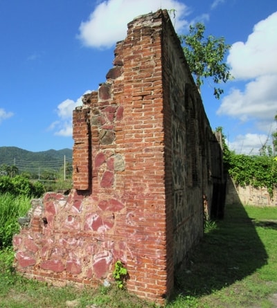
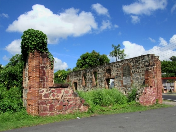
Ruins of Central Columbia
|
|
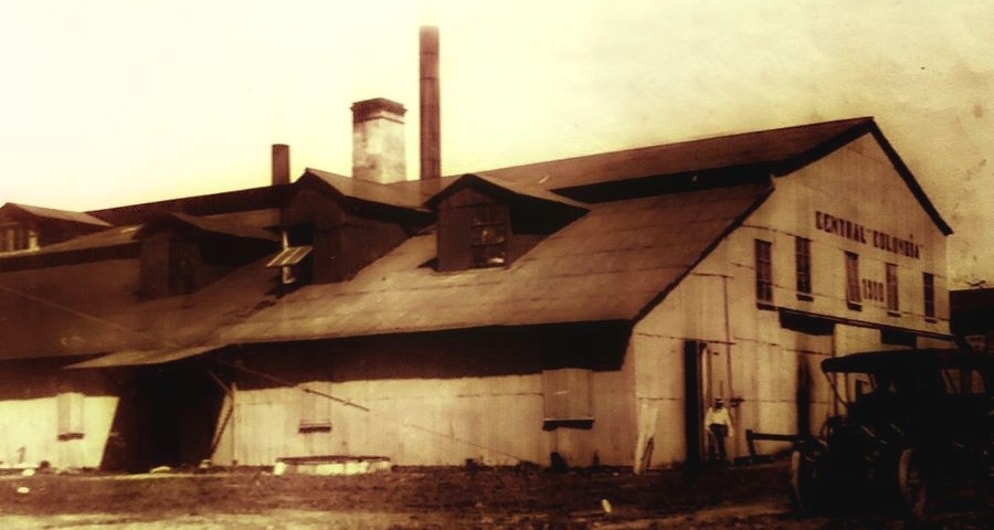
Central Columbia c.1910Photo Source: aquiestapr.com
|
Following the devastation by hurricane San Ciriaco in 1899, the major sugar plantations in Maunabo were virtually destroyed. Rather than each hacienda rebuilding its own sugar mill, the family firms of C. & J. Fantauzzi, Clausell & Verges, and the Otto Riefkohl estate got together in 1900 and agreed to build a central.
|
|
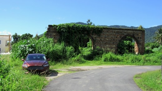
Part of the remaining ruins of the Central
|
This would be a larger processing mill than any individual hacienda could support and the sugarcane to feed the new central mill was to come from the family haciendas of Bordalesa, Orleanesa and Garona. Central Columbia was founded in 1901 and began production in 1902 with sugarcane from the family haciendas and from smaller growers associated with the three main suppliers, such as Hacienda Carolina and Hacienda Merle.
While small in size compared with the major American owned centrales in Aguirre and Guanica, Central Columbia compared well with the other mills of Central Providencia and Central Lafayette in neighbouring Patillas and Arroyo, which were also owned by the same group of families as itself. In its first year of production the volume of sugar produced by Central Columbia ranked it as the fifth largest sugar producer on the island.
Central Columbia built a narrow-gauge railway that was used to transport the sugarcane from the plantations in and around the Maunabo Valley as efficiently as possible. Despite the railway, Central Columbia was limited by is isolated location to the local sugarcane production of Maunabo, while the other mills continued to expand and bring in sugarcane from beyond their town's borders. By the 1920s, Central Columbia has become a small mill by comparison with its competitors and, when it was severely damaged by hurricane San Felipe in 1928, it did not recover and closed in that year.
While the building were a total loss as a result of the hurricane, the machinery was salvaged and transferred to Central Lafayette in Arroyo, which allowed that mill to expand. Its railway survived for some time after that, and was used to help in the collection of Maunabo's sugarcane for transportation by truck to Central Lafayette, but Maunabo's own production of sugar ceased.
|
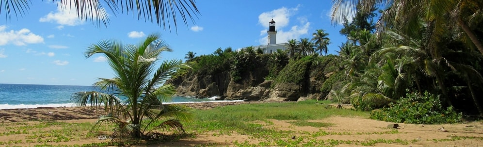
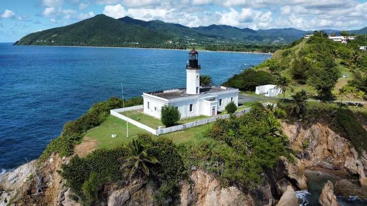
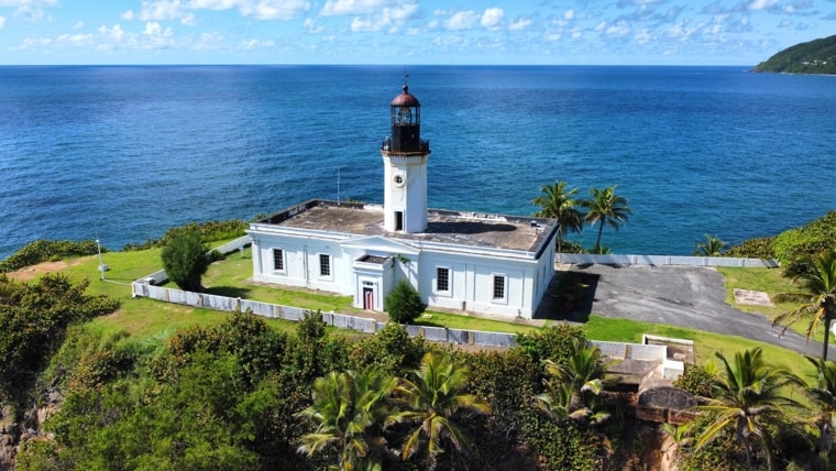
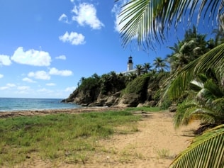
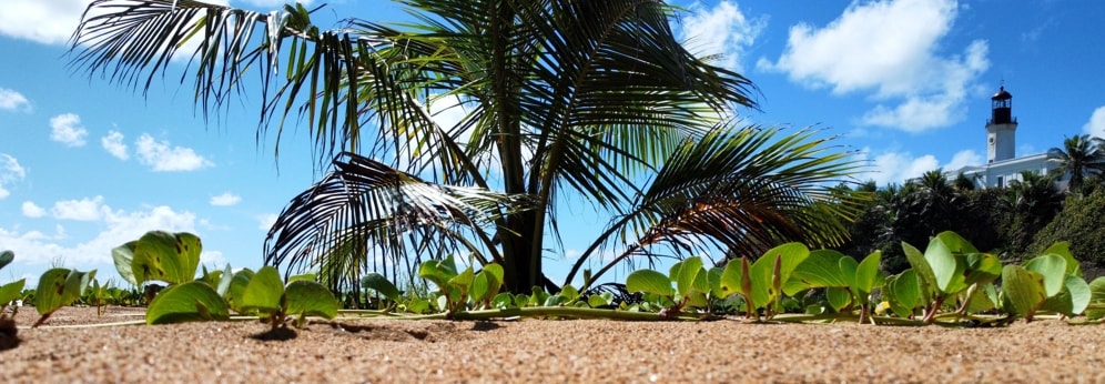
El Faro de Punta Tuna
The Punta Tuna Lighthouse ( Faro de Punta Tuna) in Maunabo is located at the most southeasterly point in mainland Puerto Rico. Built in 1893, it remains in remarkably good condition today.
|
|
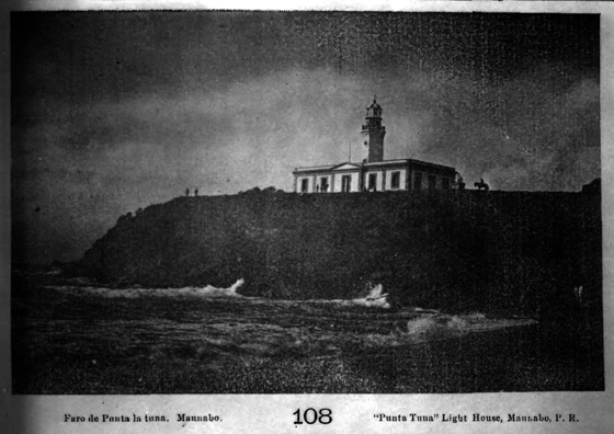
The lighthouse from the beach, c.1895 Photo Source: National Register of Historic Places
|
Originally constructed as a 3rd order lighthouse that showed a white light with a group of two flashes. It served as the most eastern primary light that terminated the Island's southern light belt, and at the same time, was the southern light that formed the Island's eastern light belt. The eastern belt was formed by another primary light at Cabo San Juan, in Fajardo, and 3 minor lights at Puerto Ferro (Vieques, South coast), Punta Mulas (Vieques, North coast) and Culebrita (Culebra).
The original design was laid out in 1890 by Joaquín Gisbert, with construction overseen by Adrián Duffaut beginning in March 1891. Construction was taken over by the Spanish Royal Corp. of Engineers and completed in September 1893.
Following the transfer of Puerto Rico from Spain to the United States, it took until May 1900 for U.S. laws to be updated to allow the U.S. Lighthouse Service to take over operations (before that, the Lighthouse Service was restricted to operate within the continental U.S.).

|
|
|
|
Looking down from the southeast
|
|
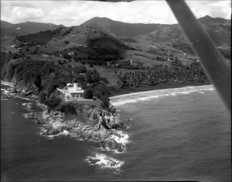
Aerial view taken during 1978 survey of PR lighthouses Photo Source: National Register of Historic Places
|
The light itself sits atop an octagonal tower of about 50ft, which is supported on a square base and is surrounded by a building which houses storage space for supplies for the light as well as the living quarters for the 2 keepers who resided on-site.
The building entrance, which stands out from the main structure, is a later addition in front of the original doorway. The entrance opens to the East with the whole structure placed as far out on the Punta Tuna peninsula as possible. Surrounded on three sides by water, the lighthouse sits over cliffs that plunge 60 feet to the Caribbean Sea which embraces the rock and its structure at West, South, and East.
The lighthouse was added to the National Register of Historic Places in 1981 based on a survey conducted in 1978. At that time much of the original mechanical components were still in place, through repairs and updates had taken place numerous times in its history.
The light was still in operation in 1989 when its functions were automated, though sometime after that it stopped being used, as with other lights, overtaken by more modern technology.
More recently it was acquired by the Puerto Rican government and restored by the Maunabo municipal government. Having been damaged at various times in its lifetime by hurricanes assaulting Puerto Rico from the southeast, it was again a victim in 2017 when Hurricane Maria struck. Despite these attacks on its structure, as can be seen from the photos, it has been kept in a better state of preservation than many lights around the island.
|
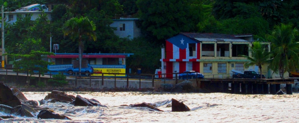
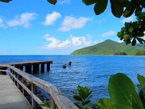
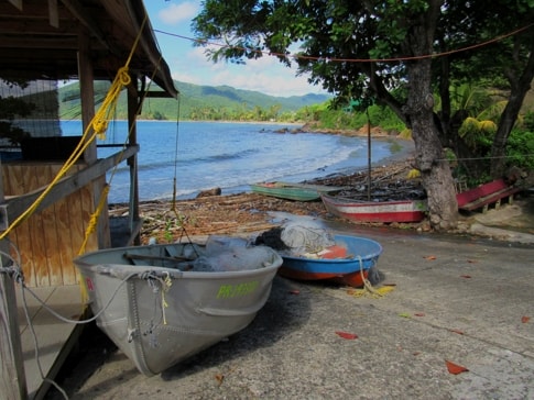
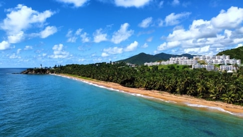
Puerto de Maunabo
|
|
Puerto de Maunabo viewed from Los Bohios Beach
|
Puerto de Maunabo (Port of Maunabo) is a sheltered area on the coast between the centre of town and Punta Tuna traditionally used by boats calling at Maunabo. This also includes the Villa Pesquera or Fishing Village where the town's fishermen keep their boats.
|
|
|
|
Looking out past the jetty and across to California Beach
|
|
Fishing boats
|
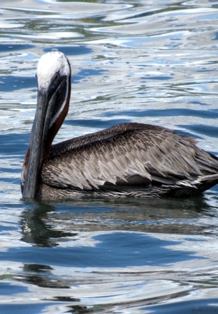
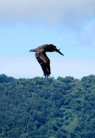
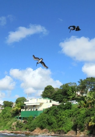
People are not the only residents around Puerto de Maunabo who are interested in fishing its clear waters. The photos below show some of the local pelicans, relaxing on the water and then taking to the air to check out what's available before diving into the water.
|
|
|
|
|
|
Pelican floating near Villa Pesquera
|
|
Surveying the waters
|
|
Diving for fish
|
|
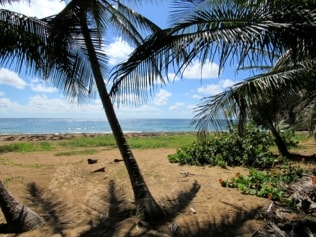
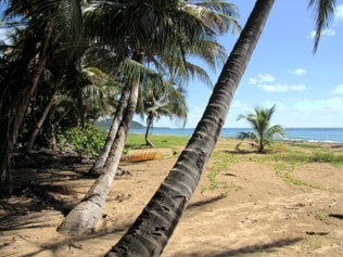
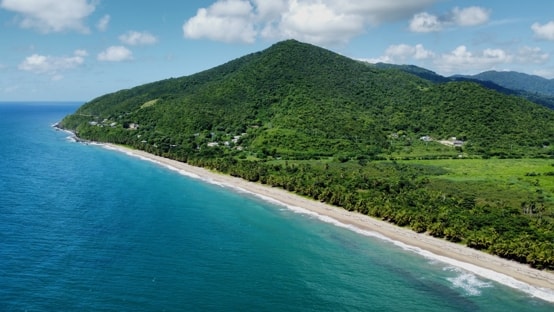
Beaches of Maunabo
Having a coastline on two of its sides, Maunabo is blessed with a number of beaches, despite its surrounding mountains reaching down to the sea at various places. Here are views from a few of the Beaches of Maunabo (Playas de Maunabo).
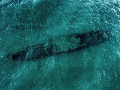
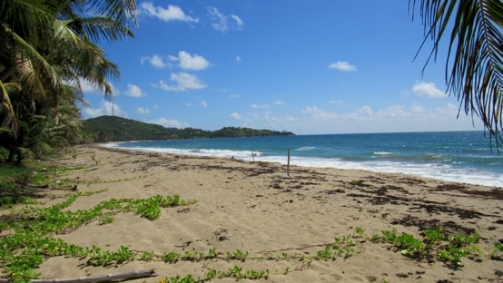
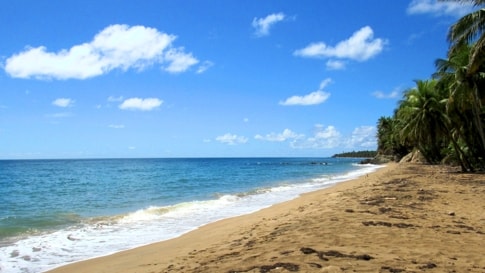
Playa California
California Beach is located on Maunabo's South coast at the western end, towards the border with Patillas. A long sandy beach bounded at its eastern end by the mouth of Río Maunabo (Maunabo River). Near the river mouth, and a short distance offshore, a sunken boat (barco hundido) can be seen through the clear waters.
|
|
|
|
The sands of Playa California
|
|
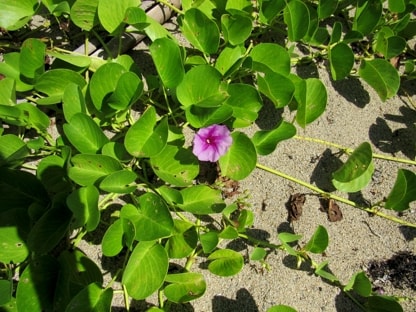
Beach flowers
|
|
|
|
|
|
|
|
El Barco Hundido
|
|
Looking eastwards along the beach
|
|
|
|
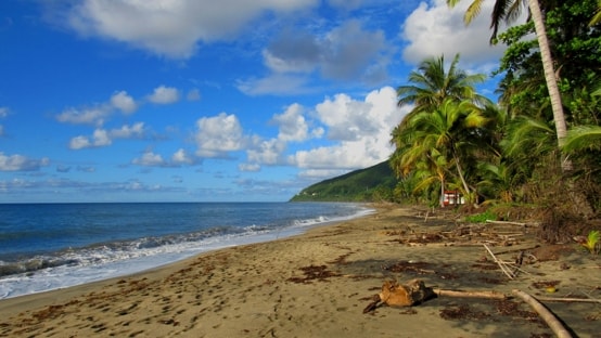
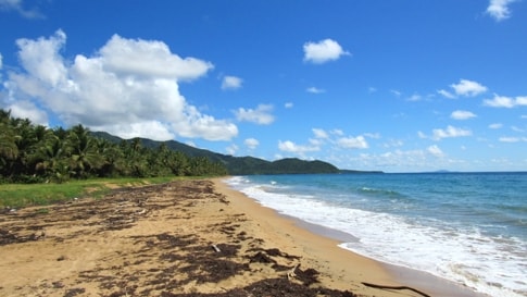
Playa Los Bohios
Los Bohios Beach is also located on Maunabo's South coast, on the eastern side of the mouth of Río Maunabo. This beach is also known as Playa Arena Negra (Black Sand Beach) as the sand can be darkened by minerals washed down from the mountains and carried by the Río Maunabo and Quebrada Arenas rivers into the sea, from where it is washed back onto the beach to change the colour of the sand. The sandy beach stretches from Río Maunabo untill the coastline curves towards Puerto de Maunabo and the peninsula of Punta Tuna.
|
|
|
|

|
|
|
|
The black sands
|
|
Looking West from the eastern end of Playa Los Bohios
|
|
|
|
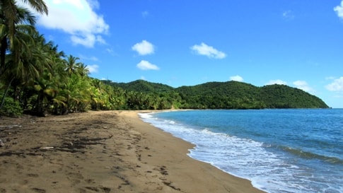
Playa Punta Tuna
Playa Punta Tuna Beach is on Maunabo's East coast at its southern end. It begins just below the lighthouse on the Punta Tuna peninsula and stretches northwards on the edge of the Punta Tuna Wetlands Nature Reserve.
|
|
Punta Tuna Beach below the lighthouse
|
|
|
|
|
The sands of Playa Punta Tuna stretch out to the North
|
|
Playa Punta Tuna stretching South to the lighthouse
|
|
|
|
|
|
|
|
Playa Emajagua
Continuing northwards after Punta Tuna Beach brings you to Emajagua Beach. This reaches to where the coast turns eastwards, a little before the border with Yabucoa.
|
|
|
|
Looking North from the lower end of Playa Emajagua
|
|
The southern end of the beach
|
|
|
|
|
Other scenes from around Maunabo
Bandera de Hector
|
|
|
Bandera de HectorPhoto Source: Hector PR - Facebook
|
|
|
|
|
Bandera de Hector at "Central Columbia" Photo Source: adictosadescrubrirpr.com
|
|
|
|
|
Ruins of Central Columbia
|
|
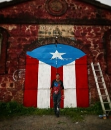
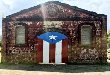
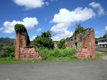
The Maunabo version of La Bandera de Hector (The Flag of Hector), was painted on a door of part of the ruins of the Central Columbia. Unfortunately, this edition of the 78 flags was destroyed by Hurricane Maria, less than a year after being painted.
The photo at the left shows the flag as painted by Hector in January 2017, while the middle photo has the flag in a fuller view of the ruins. Today, the right photo shows the same part of the ruins of the Central Columbia as left by the hurricane.
|
Plaza de Recreo
|
|
|
|
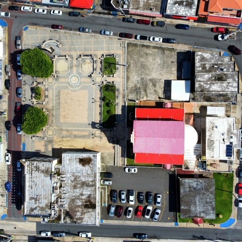
A bird's eye view of the Plaza de Recreo
|
|
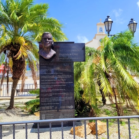
Monument to José Gumersindo Sugrañes Díaz in the Plaza
|
|
The view looking down on the Plaza de Recreo shows the church of San Isidro Labrador y Santa María de la Cabeza to the right (East) with the red roof. The building to the lower left of the Plaza is the Alcaldía.
The monument with the bust was placed to honour José Gumersindo Sugrañes Díaz who was a prominent citizen of Maunabo for many of his 99 years. He was a representative for Maunabo in the Yabucoa municipal legislature during the years 1902-05 when Maunabo was made part of that municipality, mayor of Maunabo in 1916-17, and served the town in many other ways throughout his life.
|
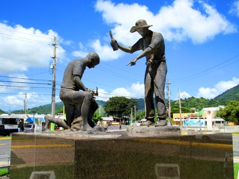
Ciudad Jueyera
|
|
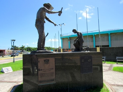
Monumento a Los Jueyeros
|
|
|
|
|
|
One of Maunabo's nicknames is Ciudad Jueyera or "Land Crab City" and it has long been known for its crabs. The photos above show the Monumento a Los Jueyeros (the Monument to the Crab Catchers) dedicated to this tradition. The wall fronting the municipal sports complex reflects this as well.
|
Early Morning Scenes
|
|
|
|
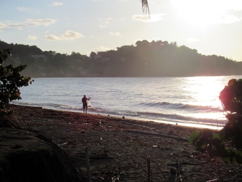
Fishing on Los Bohios Beach
|
|
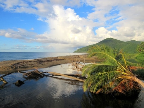
Mouth of Río Maunabo as it enters the Caribbean Sea
|
|
|
|
|