|
|
Lajas
On the South coast of the Island at the western end, the town of Lajas has only Cabo Rojo further West before the coast turns and heads North. The southern boundary of Lajas is the Caribbean Sea, while Guánica lies to the East, and to the North the town borders on San Germán and Sabana Grande. Lajas was the last of the municipalities to be separated from San Germán and was not founded until 1883.
|
|
Welcome to Lajas
|
The town's name, Lajas, is the Spanish word for "slabs", and derives apparently from early settlers in the area finding an abundance of limestone in the form of flat, smooth layers (slabs) that are easily detached and separated. The first village developed here during the second half of the 18th century.
In 1810 Teodoro Jácome Pagán was appointed mayor of the village, and he donated the land for the first chapel to be built and is considered the founder of Lajas. The chapel was rebuilt several times over the years, so that by the time Lajas became a municipality, the church was already in existence as a sub-parish and dedicated to Nuestra Señora de la Candelaria. When Lajas became a municipality in its own right, the church only needed to be separated from the primary church in Cabo Rojo which occurred in 1884.
The first petition to establish a municipality was filed in 1874, but considerable time passed without a response, so in 1882 the residents renewed their petition and requested prompt action. The Governor in 1883, General Miguel de la Vega Inclán y Palma, granted the petition and Lajas was finally separated from San Germán in 1883. This long period between the initial petition and its granting may have been caused by objections from San Germán, which saw the Lajas area as extremely important to the economic wellbeing of the Municipality of San Germán. In fact, San Germán continued to lobby for the restoration of Lajas even after 1883.
|
|
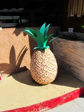
Pineapple statues are all over Lajas
|
In 1907, Juan Cancio Ortiz founded the Institute of Agriculture, Arts and Crafts in Barrio Palmarejo. This Institute later moved to the neighbouring city of San Germán and developed to become Inter-American University of Puerto Rico.
In 1922, Luis Aponte Martínez was born in Lajas, growing up to become a priest, he was raised to the rank of Cardinal in 1973, the first person from Puerto Rico and from the Caribbean to be so honoured.
Lajas lies largely in the Lajas Valley between Sierra Bermeja (Bermeja Mountain Range) to the South and Lomas de Santa Marta (Santa Marta Hills) to the North. Sugarcane was a staple crop in the valley for much of Lajas' history while other crops were grown in the higher grounds, most notably pineapple. In fact, one of the nicknames for Lajas, El Pueblo de la Piña Cabezona (The Town of Big-Headed Pineapples) is from a variety of pineapple developed and grown in Lajas. This pineapple can be seen on the flag and coat of arms of the municipality, and statues of it can be found all over Lajas.
Lajas also has a very important tourism component to its economy, largely due to its La Parguera area on the coast. Home to Bahía Bioluminiscente (Bioluminescent Bay), this along with the area's mangroves, small islands and keys attract visitors for the fishing, diving and just to relax in the beauty of the surroundings.
|
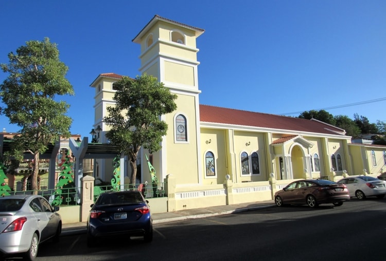
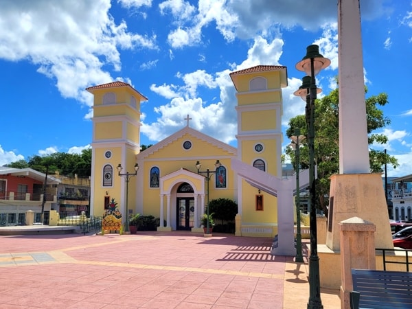
The Parish Church of Nuestra Señora de la Candelaria
There has been a church in Lajas since long before it was granted status as a municipality in its own right, with the earliest record being of a chapel built in 1824 on land donated by Don Teodoro Jácome Pagán, who is known to have been named Alcalde (Mayor) of the village in 1810. While a devote Christian, Don Teodoro did make a condition in his donation of the land to build a church, that none of his children or descendants go into the Church as a career.
|
|
Parroquia Nuestra Señora de la Candelaria
|
In 1883, when Lajas became a municipality, a permanent church was already in place, built of masonry with a tile roof and dedicated to Nuestra Señora de la Candelaria, functioning as a sub-parish of San Germán. By the following year, based on Lajas becoming a municipality and by petition from is residents, it had been separated from San Germán and became the parish church of Lajas with its first priest being Augusto Caimaris.
|
|
Parroquia Nuestra Señora de la Candelaria viewed across the Plaza
|
There have been replacements and reconstructions of the church building a number of times since the original parish church was established, with the first being a new church in masonry with a zinc roof being completed in 1897.
At least one reconstruction occurred during the twentieth century when a concrete roof was added, and a bell tower was installed. It is known that in 1951, Sergeant Antonio Camacho Lucena donated to the Parish of Lajas a bell that came from some religious ruins in Korea. The construction of a permanent parish house (which today sits opposite the church on the West side of the Plaza) dates from 1981.
The current twin towers (with one being a bell tower) date from the more recent reconstruction, testified to by a plaque on the front of the current building, which shows that the structure we see today was completed in 2003. This last reconstruction preserved at least part of the façade of the older church.
|
|
|
|
|
|
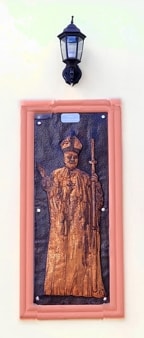
Plaque to Cardinal Aponte Martínez
|
|
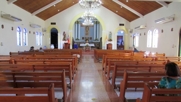
Interior of Nuestra Señora de la Candelaria
|
|
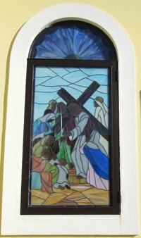
One of the church's stained-glass windows
|
|
La Parguera
|
|
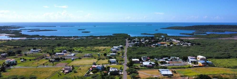
Looking down Road #343 to Bahía Montalva
|
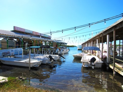
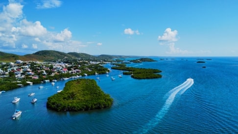
Parguera was one of the original barrios when Lajas was founded as a municipality, with the village of La Parguera being the main population area which has grown from a small fishing village to be the centre of tourism in Lajas. Home to Bahía Bioluminiscente (Bioluminescent Bay), which attracts visitors from around the island and from outside Puerto Rico, the entire Parguera coastline is full of mangroves and wetlands covering the mainland as well as numerous small islands and keys which dot the region.
|
|
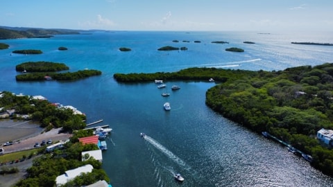
Looking eastwards with Magueyes Island at the right
|
Much of the coastal lands, covered by the mangroves, are included in a Nature Reserve, while businesses catering to visitors offer hotels, B&Bs, restaurants, bars, etc. Boats offering fishing, diving, tours of the keys and mangroves, and trips to the Bioluminescent Bay at night, all crowd the shoreline. Many residents and visitors also fill the waters with their boats.
|
|
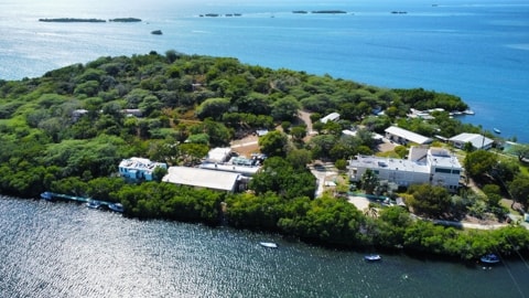
Isla Magueyes with its Marine Laboratories
|
The barrios Palmarejo to the West and Costa to the East are continuations of the same coastal features with mangroves and keys and often get grouped together under a generic term of "La Parguera" when talking about this area, so some of the photos here are from those areas as well.
|
|
Plaza San Pedro, in La Parguera village
|
La Parguera is one of three places in Puerto Rico that has a very unique and remarkable night time phenomenon, a Bioluminescent Bay. When the still waters of the Bay are disturbed, they glow with millions of microscopic organisms known as dinoflagellates which sparkle and create a spectacular light show. This phenomenon occurs only in tropical areas, typically in mangrove-protected bays such as the one found here at La Parguera. While dinoflagellates occur in the oceans all over the world, bays like the one in La Parguera tend to create a concentration at levels that allow the bioluminescence to be clearly seen.
Puerto Rico is the only place on the planet that has three sites where you can depend on this phenomenon to occur every night, with La Parguera being one of them, though the phenomenon is best observed during a dark moonless night. There are numerous tours offered around La Parguera by small boat and kayak operators to the Bay at night.
|
|
|
|
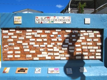
Muro de los Deseos (Wishing Wall)
|
|
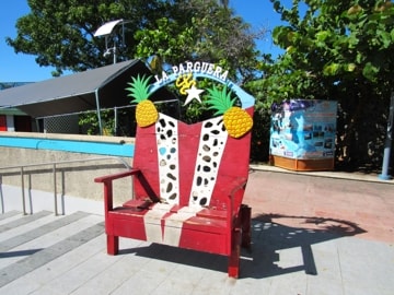
La Parguera's Flag Chair in Plaza San Pedro
|
The area has a rich, biodiverse environment beyond the Bioluminescent Bay and the small island of Magueyes, just off the coast of La Parguera, is home to Marine Biology Laboratories from the Mayagüez Campus of the University of Puerto Rico.
Beyond the natural environment, La Parguera offers visitors a relaxed atmosphere, with beachside houses and family-owned resorts. Houses line the coast and boats with fishermen come and go. The town centre offers a lively ambiance where everyone can enjoy fresh seafood and sample different food kiosks.
|
|
|
|
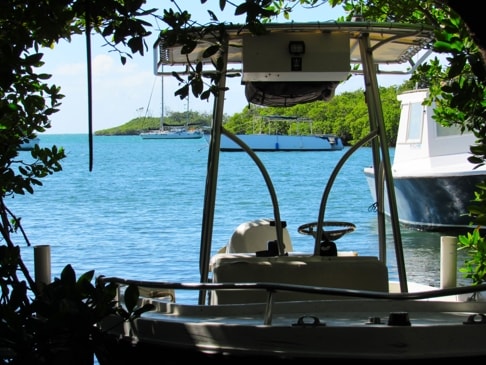
Peeking through a break in the mangroves at anchored boats
|
|
Tour boats resting in the early morning
|
|
|
|
|
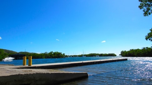
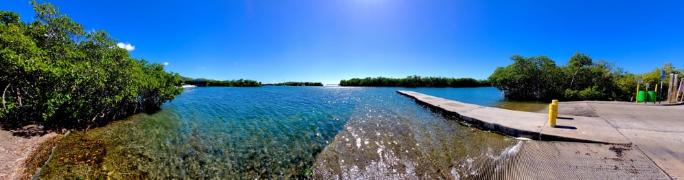
"Las Crayolas" boat ramp
|
|
Looking East from Palmarejo towards La Parguera village
|
|
|
Looking out from "Las Crayolas" boat ramp
|
|
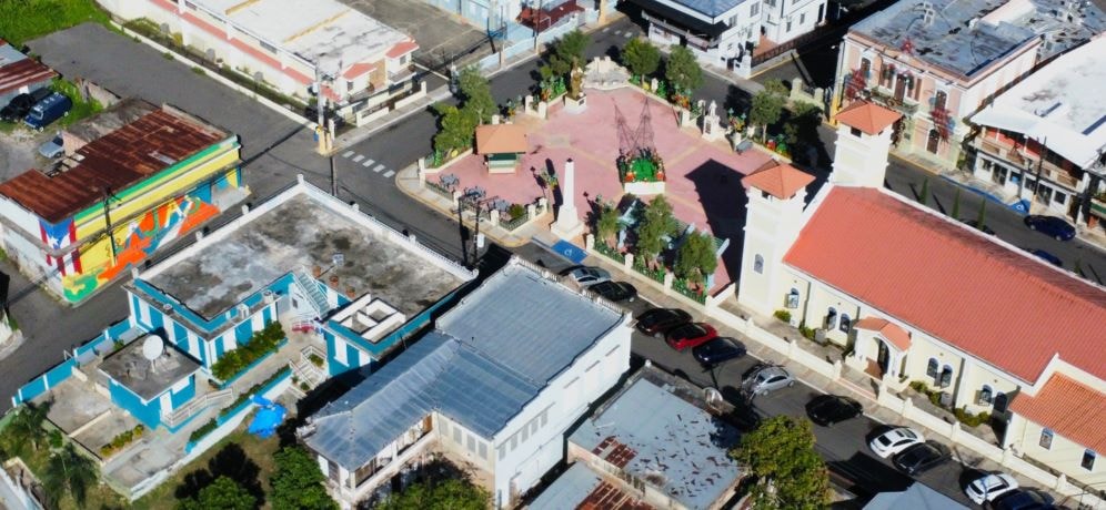
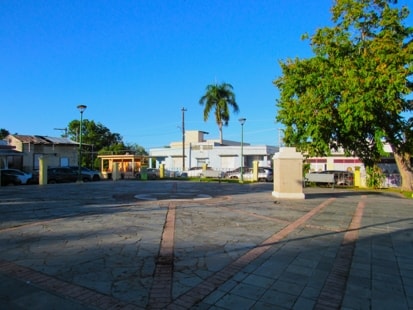
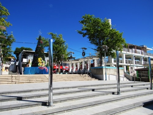
Views Around thePlaza de Recreo
Plaza Juan Ramirez Ortiz, (the Plaza de Recreo) is home to the parish church, Casa Alcaldía and other features of interest.
Monuments in the Plaza
|
|
|
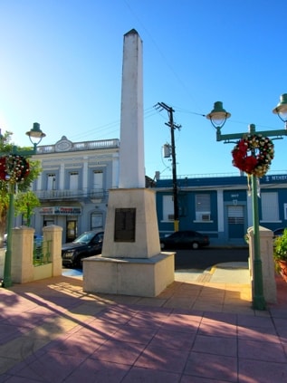
Korean War Memorial
|
|
|
|
|
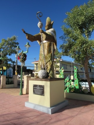
Cardinal Luis Aponte Martínez
|
|
|
|
|
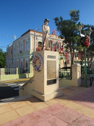
El Soldado Lajeño
|
|
|
The war memorial dedicated to those from Lajas who fought in the Korean War. Erected by the Combatants of Korea Club of Lajas.
|
|
Born in Lajas in 1922, and appointed cardinal in 1973, the first priest from Puerto Rico and the Caribbean to receive such an honour.
|
|
Dedicated to soldiers from Lajas who died in various wars, from World War II on. Moved to other locations, it was reinstalled in the Plaza in 1994.
|
Around the Plaza
|
|
|
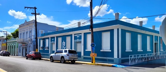
Oliver Hazard Perry Graded School
|
|
|
|
|
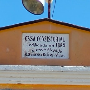
Casa Consistorial
|
|
|
The Oliver Hazard Perry Graded School (La Perry) is the earliest extant school building built by the Department of Education of Puerto Rico in the Municipality of Lajas using permanent materials. The original building constructed in 1904 had three rooms, but was expanded in 1907 to have 4 classrooms and an office.
|
|
The original plaque testifying to the construction of the Alcaldía in 1889 as the Casa Consistorial (Town Hall).
|
|
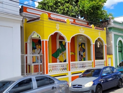
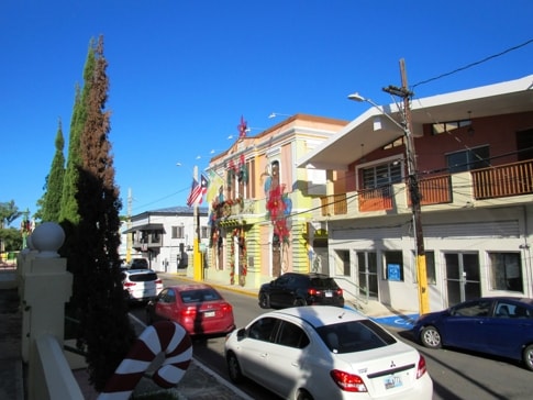
Other scenes from around Lajas
Along Road #116
|
|
|
|
|
|
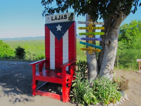
Located in the shade of a tree by the side of the road, providing an intesting opportunity for photos with the Lajas Valley in the background
|
|
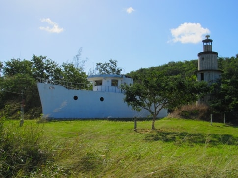
A field at the roadside is not where you expect to find a boat sailing, but in Lajas, it is really a house built in the shape of a boat.
|
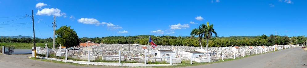
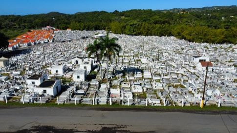
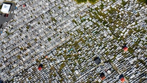
Municipal Cemetery
|
|
A panoramic view of the cemetery
|
|
|
|
|
Looking from the East side of the cemetery
|
|
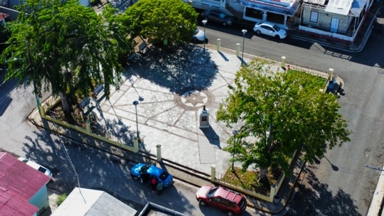
An aerial view looking down on the cemetery
|
|
|
The Lajas Municipal Cemetery is located South and a little to the West of the downtown area. The earliest graves date from 1885, shortly after the founding of Lajas as a municipality.
|
Plaza Vivoni
|
|
|
|
|
A small plaza a couple of blocks the southeast of the plaza de recreo, Plaza Vivoni is named after the first Alcalde (mayor) of Lajas, Pedro S. Vivoni, who served from its founding in 1883 until 1885. Vivoni was instrumental in the petitions to separate Lajas from San Germán and become a municipality in its own right. As well as two other terms as Alcalde he also served multiple terms as representative to the House of Delegates.
|
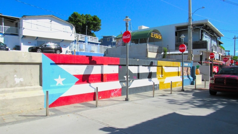
Bandera de Hector
|
|
|
The Lajas edition of the Bandera de Hector is located in La Parguera village. Close to the centre of the main hotel area, this version features a triple flag design painted on a wall at the side of Avenida La Parguera.
|
|
|
|