|
|
Hatillo del Corazón
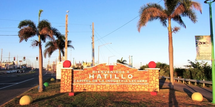
Hatillo is a town on the North coast of Puerto Rico to the West of Arecibo. Producing a third of the milk consumed in the whole island, it is known as, "Capital de la Industria Lechera" (Capital of the Dairy Industry).
|
|
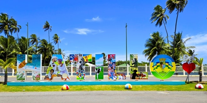
Welcome to Hatillo
|
The town, while known today simply as Hatillo, was founded in 1823 with the name Hatillo del Carazón, which is as it still appears on its coat of arms.
At the beginning of the 19th century, Hatillo was part of the Hato Grande barrio of Arecibo. With growth in populations, Hato Grande was subdivided into Hato Arriba, Hato Bajo and Hatillo. Further development of the area allowed Hatillo to petition to become a town in its own right and in 1823 the new municipality of Hatillo del Corazón de Riego was founded on land provided by Don Agustín Ruiz Miranda, with Don Francisco Martínez as its mayor.
|
|
The Letters of Hatillo
|
There are various explanations proposed as to the reason for the town's original name, with the most likely being that it is named for the árboles de corazón (ox-heart trees) found in the area. It is also speculated that the name of Hatillo is linked to the uprising that Don Rafael de Riego initiated against the absolutist government of King Ferdinand VII. In tribute to his libertarian feat, the name of "Hatillo del Corazón de Riego" was given to the new town.
|
|
The importance of the dairy industry is evident
|
Hatillo's growth was rapid, once it became a municipality in its own right and during its first two years, the population increased from 910 inhabitants to 2,663. At this time, the town also counted with two sugar plantations: the "Santa Rosa" and the "Perseverancia".
Along with a number of other towns on the island, Hatillo lost its status as an municipality in 1902 under a law to consolidate municipalities and was merged into Camuy. However, this was reversed in 1905 when the law was repealed by a new state Legislature and Hatillo regained its status.
Despite many changes over the years, today Hatillo continues to enjoy an economy dominated by agriculture and remains the island's leader in dairy production.
|
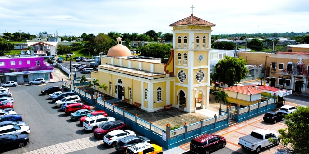
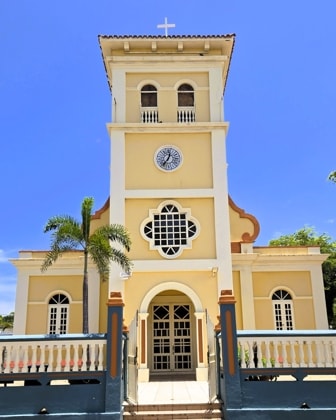
The Parish Church of Nuestra Señora del Carmen
|
|
Parroquia Nuestra Señora del Carmen
|
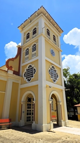
The parish church of Nuestra Señora del Carmen in Hatillo occupies a block to itself in the centre of the town on the East end of Plaza José R Millán. The church is well oriented, being built on an east-west axis with its entrance facing west. The building is surrounded by a concrete wall, balustraded on top and interrupted by pillars at intervals. Metal grillwork gates control access at the front and side entrances.
An earlier church was constructed between 1824 and 1830, corresponding to the founding of the town as a municipality. The was replaced by the current structure in masonry, which was designed by Pedro A Beibal in 1870 with the completion of construction in 1879, which makes it one of the oldest surviving building still in use in Hatillo.
The building's plan consists of a nave and two aisles, with four arches resting on square pillars separating the aisles from the nave. The original roof was made of wood beams and layers of brick covering the naves and apse. This was replaced in 1930 with a flat concrete roof over the naves and a lanterned concrete dome over the square apse. The tower was also added at that time. There are some modern features which were changed later including wood and plexiglass doors, aluminium louvered windows, and terrazzo floors.
Despite these changes, the general tone and structure still maintain the original Beibal design, and Parroquia Nuestra Señora del Carmen was added to the National Register of Historic Places in 1984.
|
|
|
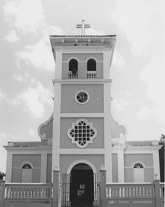
Front view of the church in 1984Photo Source: National Register of Historic Places
|
Front view of the church today
|
As is traditional in Puerto Rico, the plaza, church and city hall have always been the centre of town life. The historic relationship between these three urban elements has been maintained in Hatillo and make it a living example of the town planning characteristic of the Spanish colonial period in Puerto Rico.
|
|
|
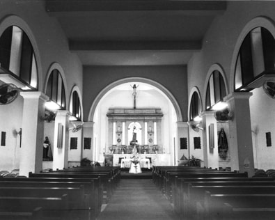
Interior view in 1984Photo Source: National Register of Historic Places
|
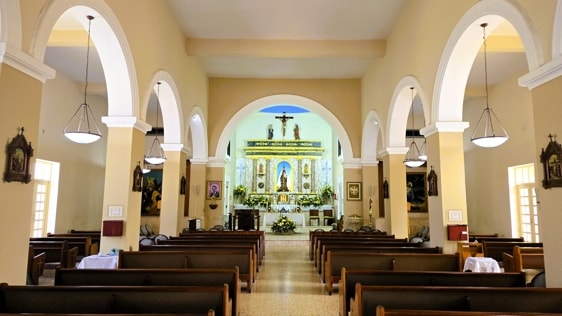
Interior view today
|
|
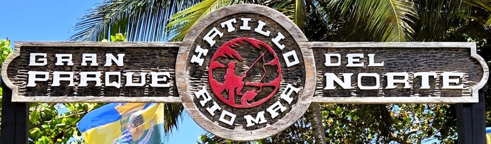
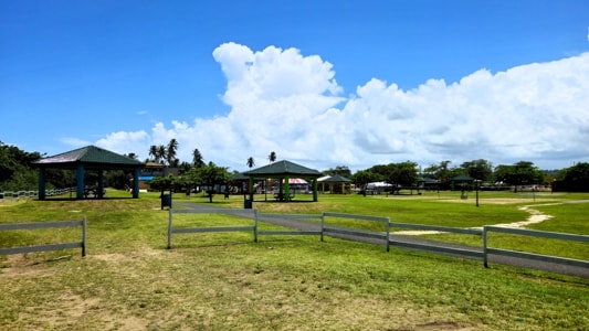
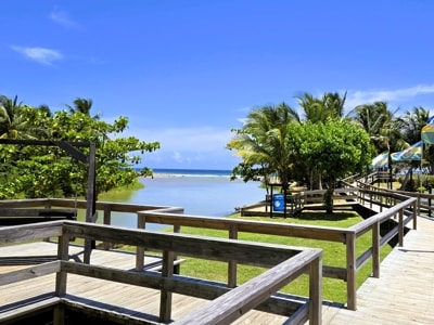
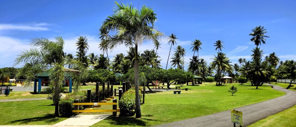
El Gran Parque del Norte
Hatillo maintains El Gran Parque del Norte (The Great Park of the North) as a recreational area for its citizens in the northwest corner of the municipality. Bordered by the Camuy River to the West and Río Mar beach to the North, this provides a beautiful space to walk, picnic or enjoy the children's amusment park.
|
|
|
The park offers wide open spaces with gazebos for picnicing
|
A riverside boardwalk runs by the Camuy River to the ocean
|
|
|
|
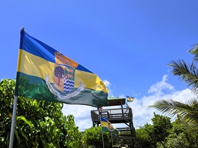
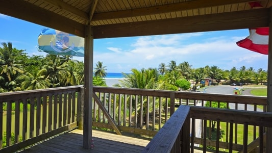
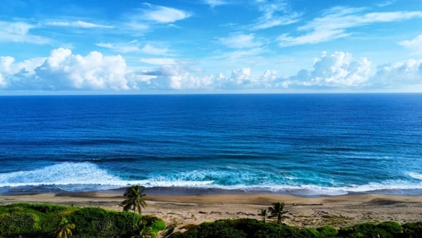
There is a lookout tower on the boardwalk
|
View from the top of the lookout
|
|
|
|
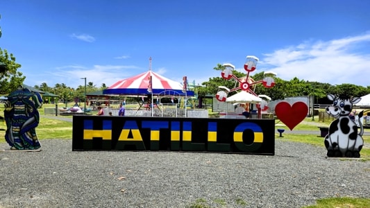
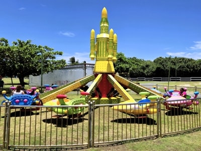
The children's amusment park is in the middle
|
Plenty of rides to try
|
|
|
El Gran Parque del Norte
|
|
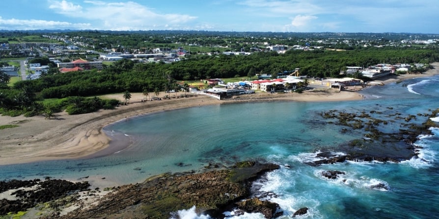
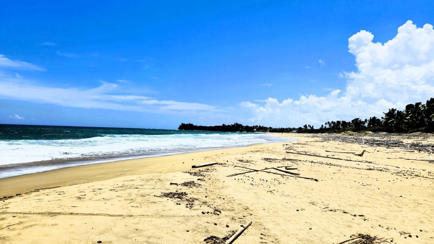
The Beaches of Hatillo
From its eastern border with Arecibo, the coast of Hatillo runs westwards to the Camuy River which forms the border with the town of Camuy. A number of beaches can be found along this stretch of the Atlantic Ocean coast.
Carrizales Beach
|
|
Carrizales Beach
|
Carrizales Beach is found at the eastern border of Hatillo with Arecibo and is a continuation of the beach line from Arecibo. Largely bordered by commercial and industrial properties, it does not receive much in the way of visitors except for residents towards its western end.
|
|
Carrizales Beach
|
Playa El Tropiezo
|
|
|
|
Playa El Tropiezo
|
|
Tidal pools behind the rocky ridge
|
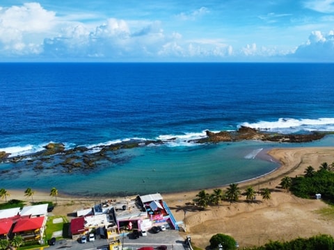
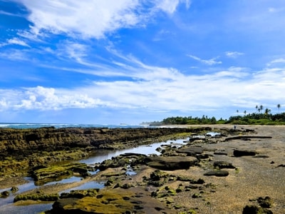
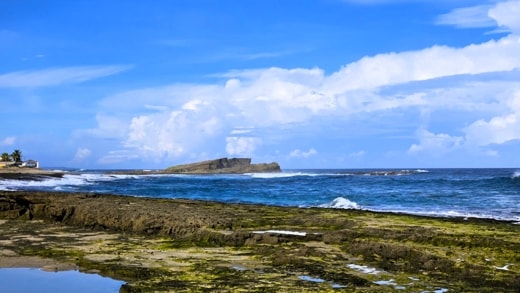
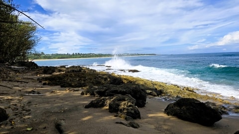
Playa Tropiezo, is a quiet beach that offers a wide sandy stretch that hides behind a long rocky ridge that protects it from the ocean. Tide pools on the sandy side provide a quiet spot for children to bathe, while the more adventurous need to navigate the sharp rocks for more open water.
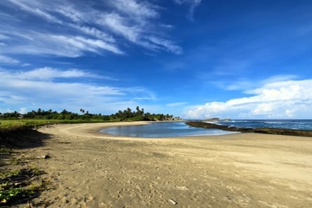
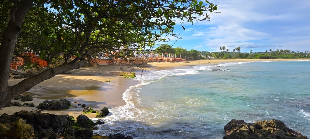
Playa Sardinera
Continuing westwards along Hatillo's coast one immediately finds Playa Sardinera with a wide curving, sandy beach protected by the rocks which continue on from Playa Tropiezo.
|
|
Playa Sardinera
|
Hatillo Beach
The next beach along the coast is Hatillo beach. This continues the rocky barrier that characterises the beaches here.
Playa Mar Azul
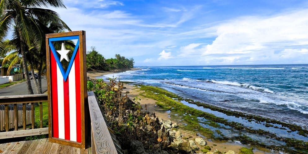
As we continue moving East to West along Hatillo's coast, the next beach we find is Playa Mar Azul (Blue Sea Beach). This lies immediately adjacent to Hatillo Beach, in front of the park of the Mar Azul neibourhood. Avenida Malecón runs parallel to the beach and slightly above it, making for beautiful views while driving along.
|
|
|
|
Looking out from Ave. Malecón
|
|
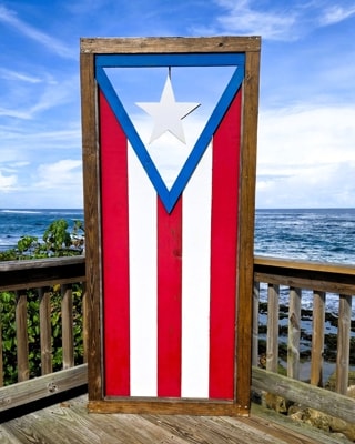
Flag designed so sky is the blue background
|
|
|
Playa Mar Azul
|
|
|
Playa Mar Azul
|
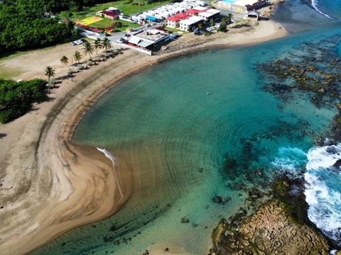
Playa Los Cabros
Playa Los Cabros lies North of the town centre of Hatillo with the beach running on to continue in front of Paseo Del Carmen. The latter was a pretty boardwalk running above the beach, but is now only ruins caused by the ravages of a number of hurricanes which have also severely eroded Los Cabros Beach. The area below Paseo Del Carmen continues to offer a curving, sandy beach, despite the damage above.
|
|
|
|
Playa Los Cabros
|
|
|
Looking to the ruins of Paseo Del Carmen from Playa Los Cabros
|
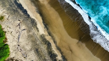
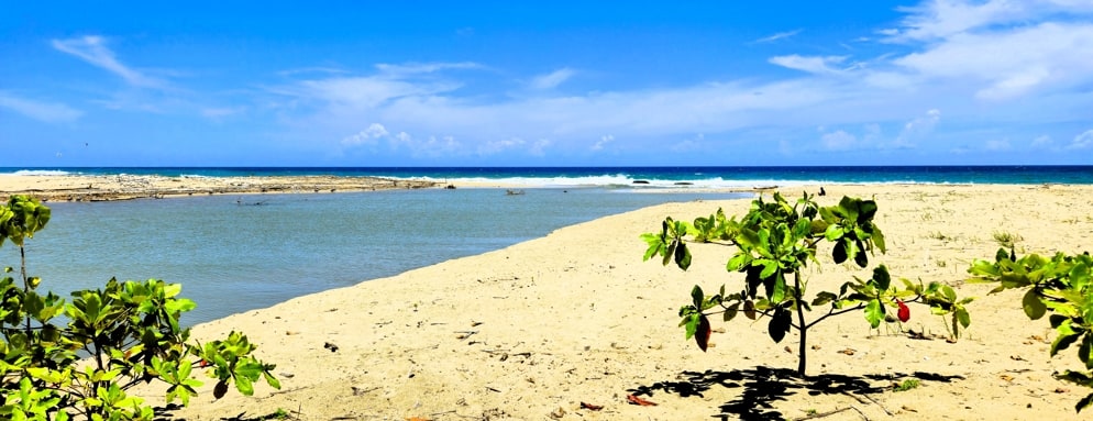
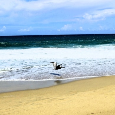
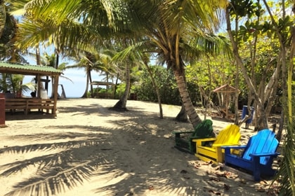
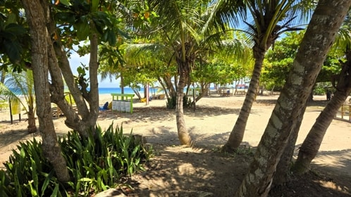
Playa Río Mar
|
|
Río Mar Beach next to Río Camuy
|
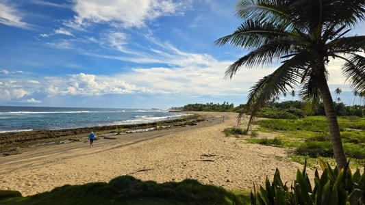
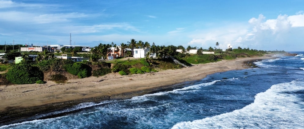
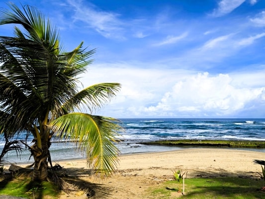
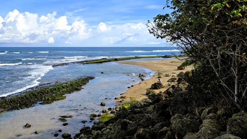
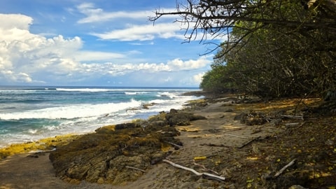
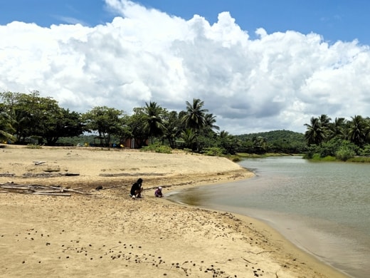
At the far West of Hatillo's coastline where Río Camuy empties into the Atlantic Ocean is Playa Río Mar. The beach stretches across the northern edge of El Gran Parque del Norte which enhances the attractiion of both beach and park.
|
|
|
|
Some visitors enjoying the beach
|
|
Another visitor
|
|
|
|
|
There is plenty of space under the palms and other trees to find shade
|
|
|
Playa Río Mar
|
|
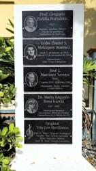
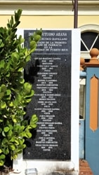
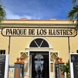
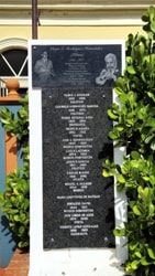
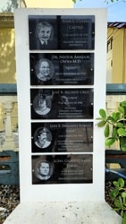
El Parque de los Ilustres
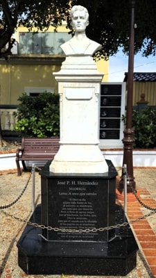
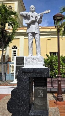
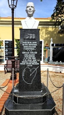
In a small space opposite the Casa Alcadía, and hugging the South side of the parish church, is El parque de los Ilustres (The Park of the Illustrious), dedicated to remembering and honouring citizens of Hatillo who made of name for themselves. Engraved plaques on a number of columns carry the names of the people honoured in the park, as well as statues of some of those most well known.
The statues in The Park of the Illustrious are of José P H Hernández, poet; Miguel Ángel Alcaide Santiago, singer and composer; and Oscar Colón Delgado, painter.
|
|
|
|
|
|
José P H Hernández
|
|
Miguel Ángel Alcaide Santiago
|
|
Oscar Colón Delgado
|
Hernández was born in 1892, and grew up in Hatillo but moved away to complete his studies. He returned later to practice his profession as a pharmacist in the town, alongside which he developed his modernist poetry.
Miguelito Alcaide was born in Hatillo in 1934. He was self-taught on the guitar and began to perform professionally at 14 years of age. Miguelito performed with many trios, quartets and other musical groups over the length of his career and is credited by some as having been the greatest guitarist of the 20th century.
Oscar Colón Delgado was born in 1889 and grew up in Hatillo. He showed signs early on of his interest in painting and was self-taught from books on art. After leaving school at 15, he moved to Arecibo where he spent most of his life. Working as a messenger and later as a telegraph operator, he developed his artistic talents in his spare time.
|
Other scenes from around Hatillo
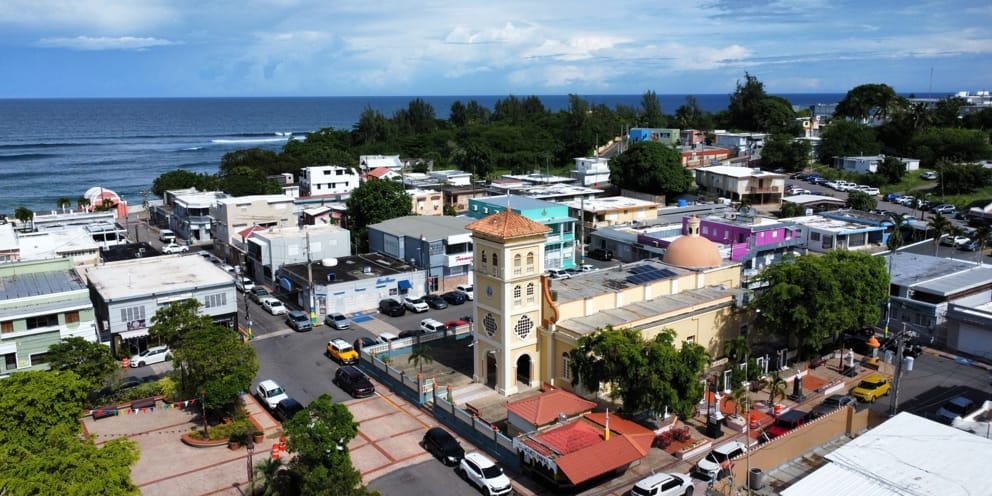
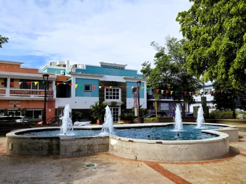
Around Plaza José R Millán
|
|
|
|
This view across the Plaza to the Atlantic Ocean shows how close to the water the centre of town is located.
|
|
|
|
|
|
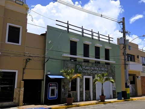
Museo de Arte e Historia Oscar Colón Delgado. The town's Art & History Museum, next to the Casa Alcaldía.
|
|
Teatro Municipal José A Monreuzeau. The Municipal Theatre sits at the West end of the Plaza.
|
|
|
|
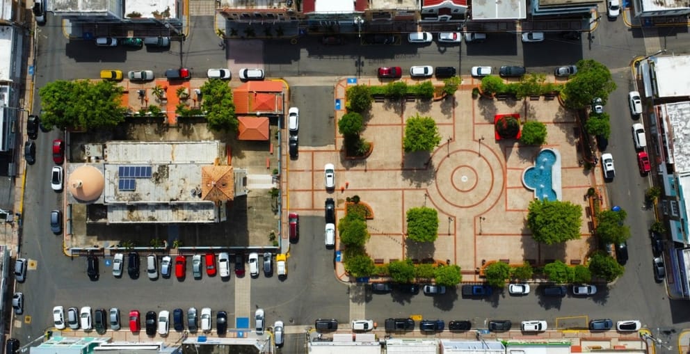
Looking directly down on Plaza José R Millán. The parish church of Nuestra Señora del Carmen is at the left.
|
Other views in Hatillo
|
|
|
|
|
|
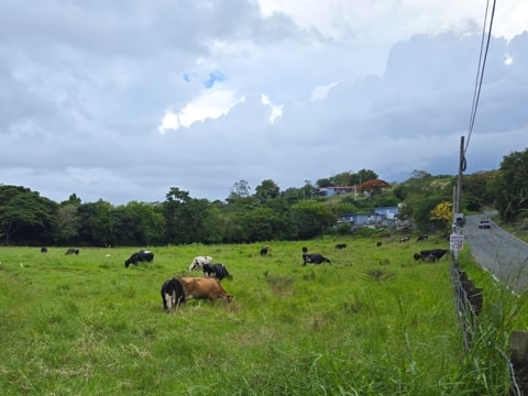
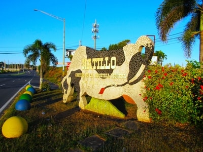
It would not be Hatillo without dairy cows.
|
|
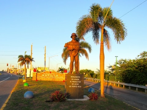
The monument in honour of milk producers.
|
Bandera de Hector
|
|
|
|
|
|
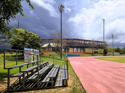
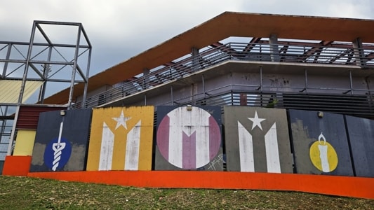
The Bandera de Hector in Hatillo is found in the municipal sports complex and, in this case, comprises multiple flags on one of the side walls of the baseball park, overlooking the athletic track.
|
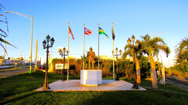
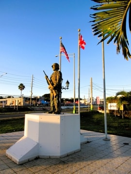
Monumento al Veterano
|
|
|
|
|
|
Hatillo's Veteran's Monument is close to the town's Welcome Sign, where Dr Susoni Ave splits off from PR Highway #2.
|
|
|
|