|
|
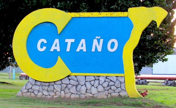
Cataño
Cataño has the distinction of being the smallest municipality (by area) in Puerto Rico. Located on the North Coast as part of the San Juan Metro Area, Cataño hugs the southern shore of San Juan Bay, over which it looks towards Old San Juan.
|
|
Welcome to Cataño.
|
The origin of the town's name dates back to the earliest days of Puerto Rico, when Francisco Bahamonde de Lugo, governor of the island from 1564-1568, saw the need to recruit a doctor from Spain to serve in San Juan. The person selected, and who took up the post, was Hernando de Cataño. As payment for his services, Cataño was given land on the opposite side of San Juan Bay. That area began, from then on, to be called after its original owner.
As a few people began to settle in the area it was declared a barrio of Bayamón, but it saw little development, mostly due to the large areas of mangroves and swamp land. Little changed over the next centuries and Cataño was for a long time no more than a name on the map.
That changed in the mid-19th century when moves were made to shift the location of transportation routes which carried goods between San Juan and other island locations. The main change was to move the principal port from Palo Seco to Cataño. After the establishment of steam ferry service between San Juan and Cataño, and later a rail line to Bayamón, the Cataño area transformed into a sizable and growing village.
Despite attempts by some of its residents to form a separate municipality, Cataño remained a barrio of Bayamón into the 20th century. This finally changed in 1927 when the insular legislature, which was controlled by politicians opposed to those in the Bayamón municipality, finally granted the petition, and the new municipality of Hato de Palmas de Cataño was founded.
While small in size, Cataño has managed to establish itself and the mangrove and swamp lands have largely been cleared. The ferry no longer plays such a central role since cargo moved to new roads over the years, but the town has developed and maintained itself as a municipality.
|
The Cataño Pyramid
|
|
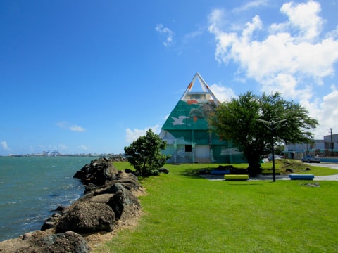
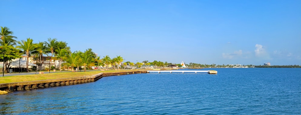
Looking West along the waterfront to La Pirámide de Cataño
|
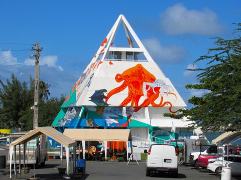
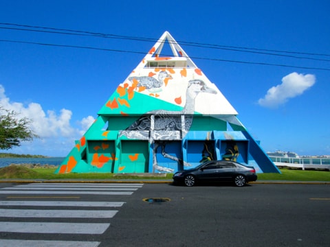
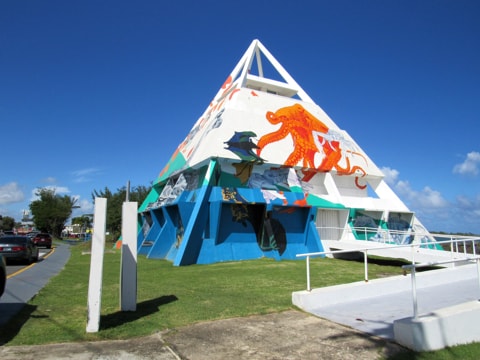
La Pirámide de Cataño (The Cataño Pyramid) was built as an attraction and lies close to the water's edge beside Las Nereidas Avenue at the western end of the waterfront promenade. The pyramid was revitalised in 2021 when artist Nathan Budoff McKibben was commissioned to paint a mural which covers the entire pyramid.
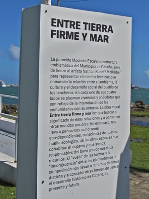
A small column in front of the pyramid explains the concept of the mural which is entitled, "Entre Terra firme y Mar" (Between Land and Sea).
|
|
Entre Terra Firme y Mar
La pirámide Modesto Escalera, estructura emblemática del Municipio de Cataño, sirve de lienzo al artista Nathan Budoff McKibben para representar elementos icónicos que enmarcan la relación entre el ambiente, la cultura y el desarrollo social del pueblo de los lancheros. En cada uno de sus cuatro lados se plasman vivencias y anécdotas que son reflejo de la interrelación de las comunidades con su entorno. La obra mural Entre Tierra Firme y Mar incita a buscar el significado de esas relaciones y a pensar en otros mundos posibles. En este caso, nos lleva a pensarnos como seres eco-dependientes, consientes de nuestra huella ecológica, de las otras especies que cohabitan el espacio y que somos responsables del buen uso de nuestros recursos. El "vuelo" de las formas y la "incongruencia" entre los elementos de la composición nos llevan a mirarnos de forma distinta y a concebir otras formas de pensar el desarrollo histórico de Cataño, su presente y futuro.
|
|
Between Land and Sea
The Modesto Escalera pyramid, emblematic structure of the Municipality of Cataño, serves as a canvas for artist Nathan Budoff McKibben to represent iconic elements that frame the relationship between the environment, culture and social development of the town of "the boatmen". On each of its four sides, experiences and anecdotes are presented that reflect the interrelation of the communities with their environment. The mural Between Land and Sea encourages us to look for the meaning of these relationships and to think about other possible worlds. In this case, it leads us to think of ourselves as eco-dependent beings, aware of our ecological footprint, of the other species that cohabit the space and that we are responsible for the good use of our resources. The "flight" of the forms and the "incongruity" between the elements of the composition lead us to look at ourselves differently and to conceive other ways of thinking about Cataño's historical development, its present and future.
|
|
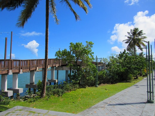
Lookout Bridge
|
|
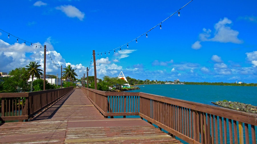
Lookout Bridge at its western end
|
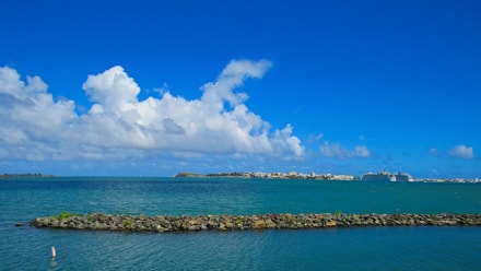
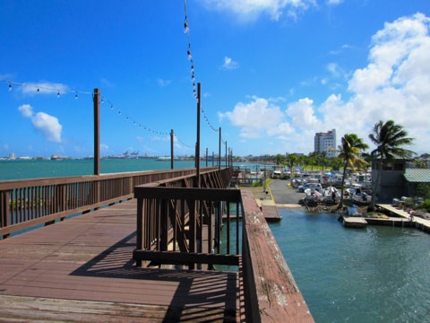
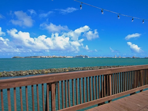
Puente Mirador (Lookout Bridge) is a wooden bridge built over the waters of San Juan Bay. Running West to East and starting close to the Cataño Pyramid at its western end, it steps out over the water to come down where the waterfront promenade begins and leads all the way into Cataño.
|
|
Looking out from the Bridge across the Bay, with the entrance between Isla de Cabras & El Morro to the left
|
The bridge provides wonderful views along the waterside, and across the Bay towards Old San Juan.
|
|
Looking East along the Bridge to Cataño & far side of the Bay
|
|
|
Looking across to Old San Juan
|
|
|
Looking back along the Bridge to the West and the Pyramid
|
|
La Lancha de Cataño
|
|
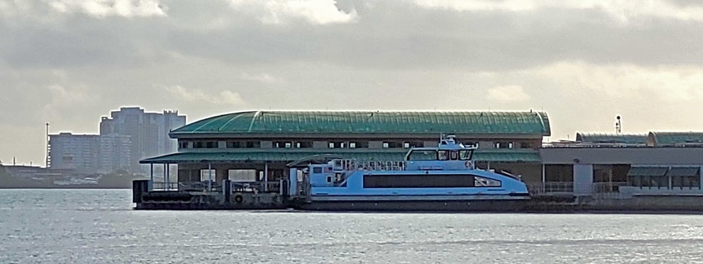
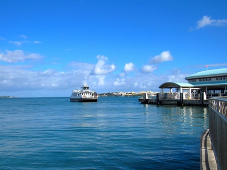
The Cataño Ferry Terminal
|
La Lancha de Cataño (The Cataño Ferry) has been a mainstay of transportation across the Bay between Cataño and San Juan since the 19th century, when its creation effectively gave birth to the town of Cataño.
Until the mid-1800s, the primary port for transporting goods and people between San Juan and towns along the North coast and to inland parts of the island, had been Palo Seco. This lies at the West side of San Juan Bay and close to the mouth of the Bayamón River. However, tides, shallow waters and dangerous currents in the area made it difficult to sail around that part of the Bay, dock at Palo Seco or navigate into Río Bayamón to sail inland, especially in bad weather.
In 1849 a group of Spanish businessmen on the island began the task to create "La Compañía Puertorriqueña del Vapor de Cataño" (The Cataño Steam Company of Puerto Rico), with the purpose of providing transport across San Juan Bay by steamboat. For this to work, the port needed to be transferred to Cataño to find the deeper water required to operate the steamboats proposed. This was finally approved in 1852 and, with the support of the government, the port was created in Cataño, and the company started promoting the area by selling land cheaply to attract the population needed to build a town that would make the port viable. As well as building the docks needed for the ferries to operate, a road was constructed from the village of Cataño to Bayamón (which still exists today as PR Highway #5).
By 1853, La Compañía Puertorriqueña del Vapor de Cataño began providing passenger and cargo service between San Juan and Cataño using the three steamboats it had bought: Costanero, Isabela and Borinqueño.
|
|
|
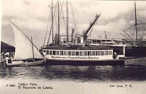
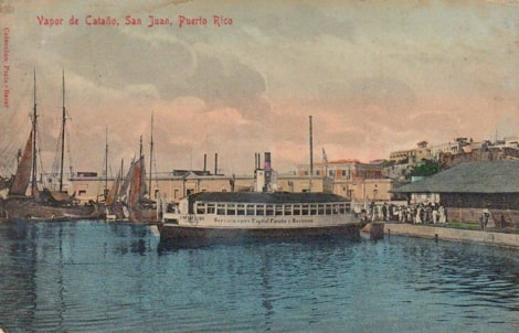
Postcards of "El Vaporcito de Cataño", (late 19th / early 20th century)
|
Despite the need to clear and drain mangroves and swamps which filled most of the area around Cataño to make it habitable, this route grew and with it Cataño grew. The expanding population around the transportation hub that Cataño became, turned it from a small village into one of the more prosperous barrios of Bayamón.
Later another company, "La Empresa Férrea del Oeste" (The West Railway Company) formed by Ramon Valdés Cobián and a group of investors, created a combined ferry and rail service to carry cargo and passengers from San Juan to Bayamón via Cataño. When the railway began operating, the boats being used for the ferry service were capable of carrying 4 railway wagons on each trip, making the transition between ferry and train extremely efficient.
Over the years the company names and ownership have changed, and by 1919 the ferry was being operated by "Bull Insular Line" when competition was created in the form of "La Compañía Popular de Transporte Marítimo" (The Popular Maritime Transport Company). The original ferry dock in Cataño was located at the mouth of the San Fernando Channel, but the new company constructed its docks round on the main beach area of Cataño and closer to San Juan to provide a shorter crossing time.
|
|
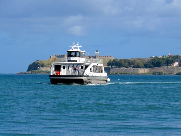
A present day ferry crossing from San Juan, with "El Morro" as a backdrop
|
The two companies continued to compete in the provision of ferry services, but finally merged in 1936. The ferry service continued to be operated in private hands until 1960, when deteriorating service and other problems forced the Puerto Rico Port Authority to expropriate the company and operate the service itself, to ensure the ferries would continue to run and provide the public service demanded by its users.
|
|
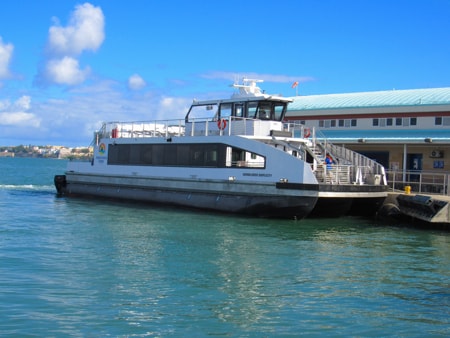
Ferry approaching Cataño
|
Over the years the ferries have been modernized, the routes were expanded as part of the AcuaExpreso project and then shrank back to the simple Cataño to San Juan route. More recently, while the ownership of the ferry routes remains in public hands, the operation has been contracted to a private company which operates the boats such as the one shown in the photos here.
|
|
Docking at the Cataño Ferry Terminal
|
|
Other scenes from around Cataño
Ron Bacardí
|
|
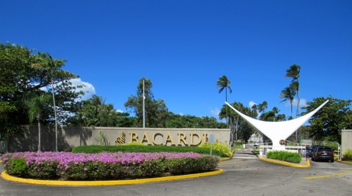
Entrance to Bacardi Rum plant
|
|
|
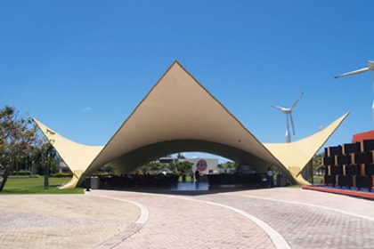
The Bacardi PavilionPhoto Source: US National Parks Service
|
|
Ron Bacardí (Bacardi Rum) has a manufacturing plant which has been a longstanding landmark in Puerto Rico. Built on the western border of Cataño close by the waters of San Juan Bay, it offers tours to visitors in attractive surroundings.
|
|
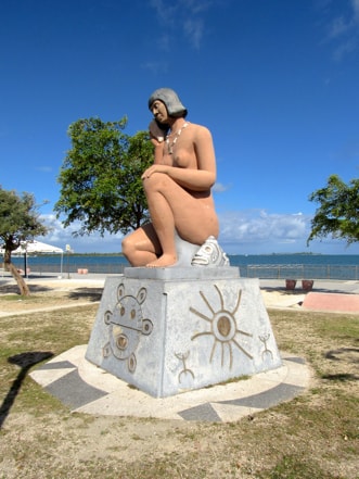
Taino Statue
|
|
Taino Statue
|
Erected on the waterfront, this statue was designed to honour Puerto Rico's Taino heritage.
|
|
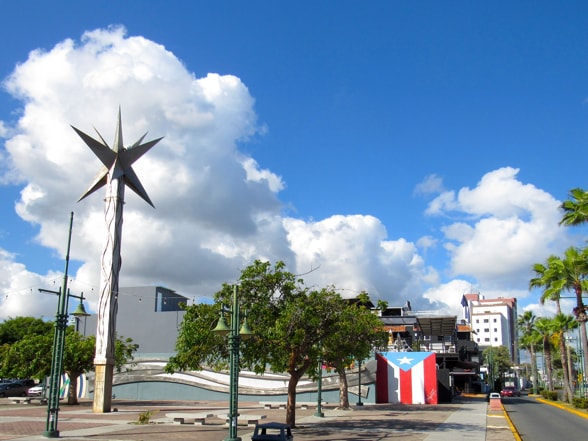
Bandera de Hector en Cataño
|
|
Bandera de Hector
|
The Bandera de Hector in Cataño is painted on the back wall of Plaza Paseo del Mar which is located between the plaza de recreo and the Cataño waterfront.
|
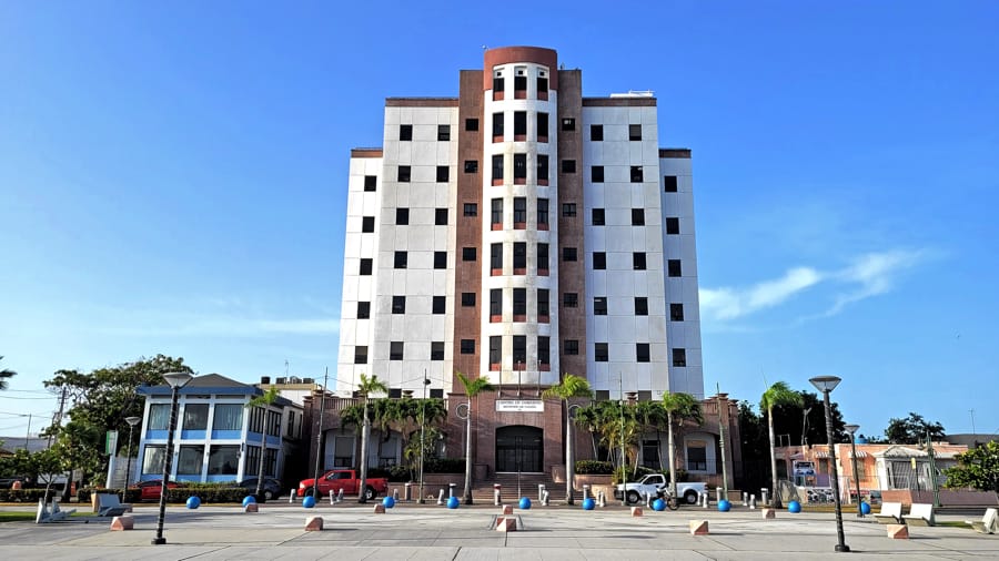
City Hall
|
|
City Hall
|
The Centro de Gobierno Municipal de Cataño (Cataño Municipal Government Centre) is a modern replacement for the old Casa Alcaldía. While the old building is just around the corner, its place on the main street in the downtown area presented a different atmosphere to that of the new office building which stands in front of the Cataño waterfront, and looks out over the waters of San Juan Bay.
|
|
|
|