|
|
Arroyo
|
|
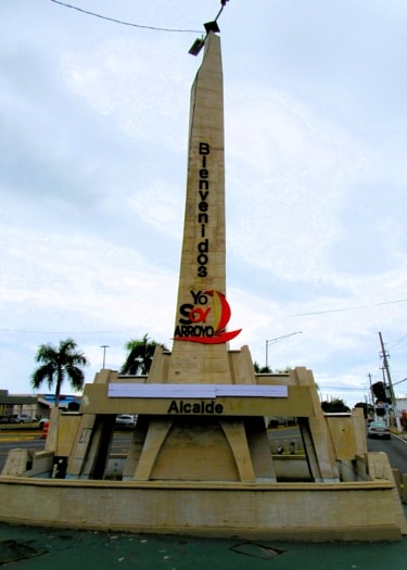
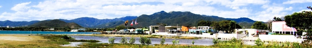
Welcome to Arroyo
|
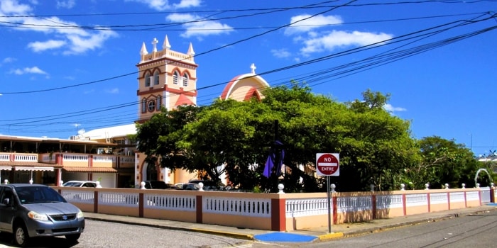
Arroyo is one of the smallest municipalities in Puerto Rico, squeezed in between the mountains and the Caribbean Sea on the southeast coast with Guayama to the West and Patillas to the East.
It is said that the town's name comes from there being a small stream ("arroyo" in Spanish) which became a stopping place for travellers in the area, who refreshed themselves in its waters. While Arroyo has only one significant river (Río Nigua) within its borders, there are numerous streams, but there is no evidence that identifies which may have been the original arroyo.
While there are various stories about how the area became settled, one of the most probable is that merchants from Guayama developed the area to take advantage of its coastline to use as a port from which to send out their goods. Arroyo certainly acted as the main port in the region for a long time and became one of the main landing places in Puerto Rico for U.S. military forces in the 1898 war with Spain. With all of this, Arroyo grew and officially became a municipality in 1855.
|
|
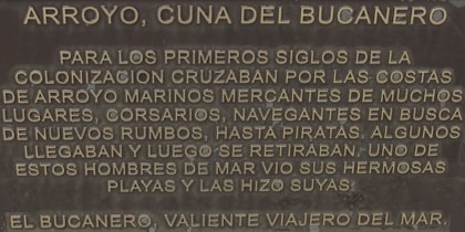
Plaque dedicating welcome monument to "The Buccaneer"
|
|
ARROYO, CRADLE OF THE BUCCANEER
During the first centuries of colonization, merchant sailors from many places, corsairs, sailors in search of new routes, and even pirates crossed the shores of Arroyo. Some arrived and then left. One of these seamen saw its beautiful beaches and made them his own:
The Buccaneer, Brave Traveller of the Sea.
|
|
As well as the commerce generated by its position as a port, Arroyo's economy was based on agriculture with the main crop being sugarcane. As in many parts of the island during the 19th century and well into the 20th, sugarcane dominated the landscape and more so in Arroyo where Central Azucarera Lafayette (Lafayette Sugar Refinery) became a major producer of refined sugar.
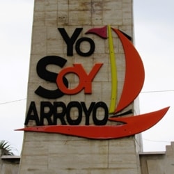
One of the nicknames for the town is Cuna del Bucanero, and in fact the welcome monument, at the intersection of Highway #3 with Road PR #178 at its western end, has a plaque dedicating the monument to El Bucanero (The Buccaneer). Residents of Arroyo are often referred to as Bucaneros and the town's sports teams typically carry this as their name or nickname.
The Central Lafayette closed in 1973, and sugarcane is no longer a significant product in Arroyo or anywhere in Puerto Rico. Today, Arroyo grows other agricultural products, raises cattle, and has industrial plants including pharmaceuticals.
|
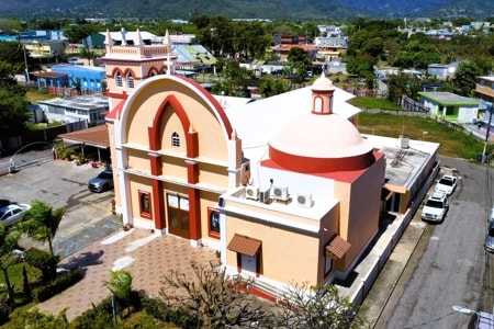
Parroquia Nuestra Señora del Carmen
|
|
Parroquia Nuestra Señora del Carmen
|
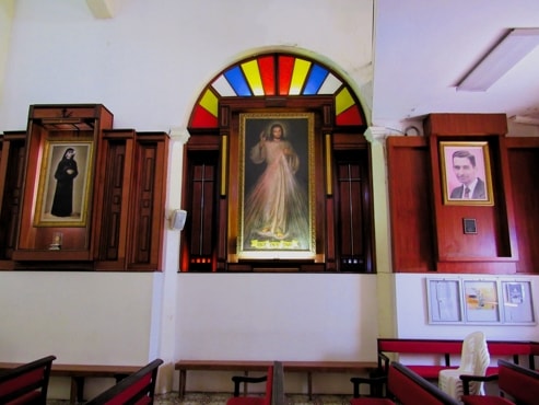
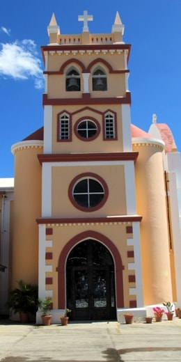
Arroyo's parish church, Nuestra Señora del Carmen (Our Lady of Carmen) was built at the same time the municipality was officially founded in 1855 and was well oriented in its original design.
|
|
The tower stands above the original entrance to the church
|
The tower was a later addition, designed by Juan Francisco Bertoli and built in 1888 in front of and above the entrance. It shares architectural elements with the towers of the parish churches of Guayama and Humacao.
|
|
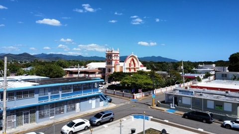
Looking across the plaza de recreo towards the parish church
|
When looking at the current structure and layout of the church from the outside, it can be quite confusing to distinguish which side is the front as there now appears to be more than one entrance. When viewed from above, there appears to be a domed sacristy opposite the tower entrance and that is where one would expect to find the altar.
|
|
The modern front façade
|
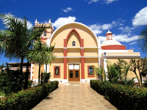
At some time after the addition of the tower, the church building was expanded to provide a greater capacity for the congregation. This was achieved by opening a side entrance with an wonderful arched wall over it and, from there building an extension crossing the original nave and ending at the side of the parish house with a new altar.
The tower and original main entrance remain in place, as does the domed sacristy, but the modern entrance from General Brooke Road now takes precedence.
|
|
High view of the full church
|
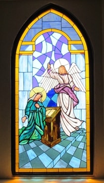
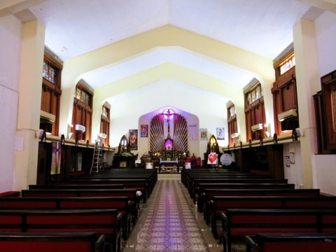
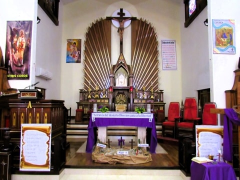
Inside the church it is easier to see which way things are arranged as the seating for the congregation and the aisle lead from the entrance door to the new altar at the rear. There are nice, stained-glass windows on either side when entering from the modern front door. All the original parts of the church remain but now stand to the sides of the modern nave.
Interior views of the church
|
|
|
|
Interior from inside the modern entrance
|
|
Interior view closer to the altar
|
|
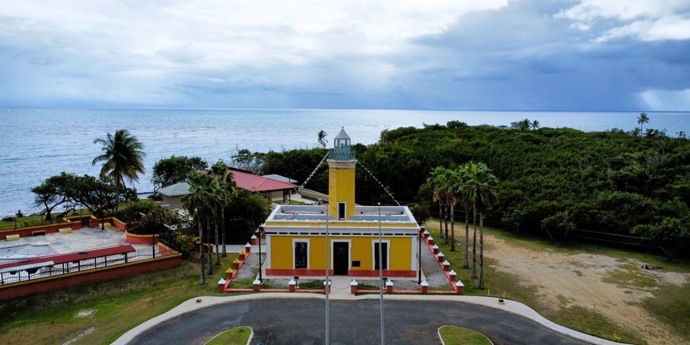
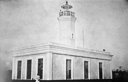
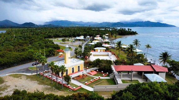
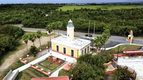
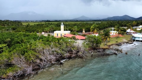
El Faro de Punta Figuras
Located on Punta Figuras (Figuras Point), this lighthouse was built as a 5th order light in 1893 to aid in navigation around the ports of Arroyo and Patillas and, set between the lights at Punta Tuna in Maunabo and Caja to Muertos in Ponce, to be part of the chain of lighthouses circling Puerto Rico. As originally built, it showed a fixed white light with a 12 mile range.
|
|
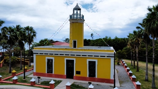
El Faro de Punta Figuras
|
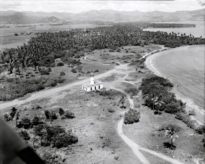
While the remains of this lighthouse are now crowded up against building from the Punta Guilarte Vacation Centre, during its lifetime as an operational light it stood on an isolated spot, close to the coast and surrounded by swampy ground with thick growths typical of its tropical location.
|
|
|
|
El Faro c.1898Photo Source: National Register of Historic Places
|
|
El Faro today
|
Built of stone and brick to a simple rectangular plan, it followed the standard layouts used at the time, providing rooms for storage and living quarters for the crews manning the lighthouse. All this surrounding a central tower supporting the lantern and the lens projecting the light. The top of the tower is octagonal, and the building contains examples of ornamentation that belie the functional nature of the structure.
|
|
|
|
El Faro today, almost surrounded by the Punta Guilarte Vacation Centre
|
|
El Faro and surroundings in 1978Photo Source: National Register of Historic Places
|
The light itself was changed in 1923 and in 1938 the light was removed to a new location and the building was abandoned. During World War II the building was reopened to use as a lookout post and then decommissioned again at the end of the War.
|
|
The grounds behind the lighthouse have also been restored
|
|
|
A view of the lighthouse from seaward
|
Some time after the War the land surrounding the lighthouse was lease to the U.S. Army, which might explain why the building survived as well as it did until the Army left in 1963. As part of an effort to maintain Puerto Rico's history, El Faro de Punta Figuras was added to the National Register of Historic Places in 1981. Finally, around 2003, the lighthouse was restored to become a museum, including the areas at the back where the well and water cistern have survived in reasonable condition.
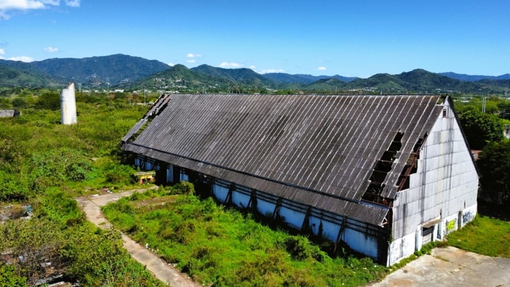
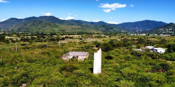
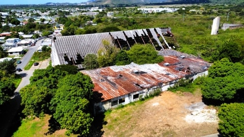
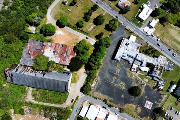
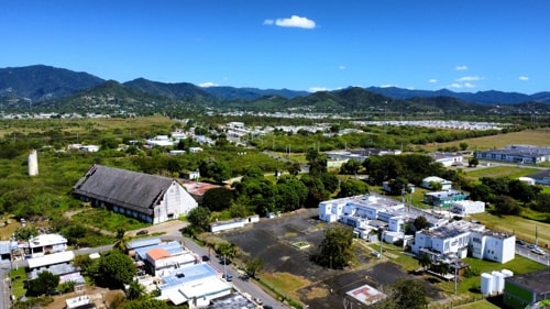
Central Azucarera Lafayette
The Central Lafayette (Lafayette Sugar Refinery) has been long closed, but its ruins remain to give a glimpse into the past when it dominated the economy in Arroyo. As a Central, it was established in 1905, but its history started a long time before that.
In 1815 a royal decree issued by King Fernando VII, permitted citizens from countries other than Spain to settle in Puerto Rico, resulting in a number of immigrants coming to the island, particularly of German, French, Corsican, Danish and U.S. origins. Amongst those, were members of the Fantauzzi family from Corsica and it is recorded that by 1844 Angel Francisco Fantauzzi Stella was recognized as a distinguished merchant residing in Arroyo. In 1851, Fanatauzzi was named Repartidor de Comercio, a sign he was indeed a respected citizen, as the Repartidor de Comercio was the person responsible for approving the tax and other collections related to business activities for the municipality.
|
|
Ruins of Central Lafayette
|
In 1852 Angel Francisco requested his nephews, José and Cruciano Fantauzzi Stella, come to Puerto Rico and by April 30, 1853 an agreement was signed between them such that José and Cruciano acquired all of Angel Francisco's business assets for 34,934 pesos. On June 20, 1853 the mercantile firm Fantauzzi Hnos. (Fantauzzi Brothers) was organized by José and Cruciano to continue the businesses they had acquired from their uncle. The establishment of Fantauzzi Hnos. was the beginning of what fifty-two years later would be Central Lafayette.
One of the main lines of business pursued by Fantauzzi Hnos. was crop financing, largely of sugarcane. Through that they developed a sugar and molasses export business and also began acquiring haciendas themselves, often when owners defaulted on the loans provided by Fantauzzi Hnos. By 1874, brothers François and Jérôme had also moved to Puerto Rico and began managing much of the business when José and Cruciano, who both married French brides, moved to live in France and became absentee owners of their businesses. François and Jérôme both became partners in Fantauzzi Hnos..
|
|
The remains of the chimney poke above the overgrowth
|
Fantauzzi Hnos. leased and operated Hacienda Cuatro Calles from 1886 to 1892 and acquired it in October 1893 when it was auctioned by the Government due to the owner's insolvency. Hacienda Cuatro Calles, located in the middle of Arroyo, was one of the largest plantations in the area, and with a steam mill, was one of the most productive.
|
|
Looking down on the deteriorated buildings of the refinery
|
Starting in the 1880s the Fantauzzi's continuously updated the machinery in all of their haciendas including Cuatro Calles to keep up with the changing circumstances in part brought about by the abolition of slavery in 1873. These updates at one point in time elevated Cuatro Calles to a Central Azucarera (Sugar Refinery), however, the exact date of the organization of Lafayette as a central sugar mill is not clear.
The eventual development of the Central was the result of the consolidation of haciendas Cuatro Calles, Ancones and Palma. With its approximately 500 acres Hacienda Cuatro Calles was the centre of the new venture.
|
|
High level view showing the Central to the left and the Hospital at the right
|
It is 1905 when the name "Central Lafayette de C & J Fantauzzi" begins to appear in legal documents (it is understood that the name came from the address of the Fantauzzi's offices in Paris; 62 Rue Lafayette). Before then, Cuatro Calles was always used when referring to this property. Sucrs. C & J Fantauzzi was organized after the death of Cruciano in 1896 and José in 1905 to engage in the agricultural, industrial and commercial business of Central Lafayette as well as of those of the haciendas Cuatro Calles, Palma, Felicita, La Vega, Garonne and the Columbia Sugar Mill in Maunabo.
|
|
A view toward the mountains shows how close are the refinery and hospital
|
Sucrs. C & J Fantauzzi continued to acquire haciendas, sugar mills and refineries that grew their businesses and the production in Central Lafayette. Though not a big sugar refinery based on production, with a maximum annual production of about 40,000 tons, Central Lafayette was a pioneer in several ways. It reportedly had the largest crushing mill of all Centrales on the island and was one of the first, if not the first, to have telephone and telegraph service.
The Fantauzzi's business savvy motivated the sale of Lafayette at a time when it was generating substantial profits. In 1936, the Central Lafayette and 10,000 acres were sold for a reported $3,815,000 to the Puerto Rico Reconstruction Administration (PRRA), the 1935 Puerto Rico branch of FDR's New Deal.
Out of the 10,000 acres of land included in the transaction, the land which was not being used for pasture was divided into 5 to 10 acre farms to be distributed amongst existing and past workers of Lafayette. The aim being for these to produce sugarcane, which would then be processed by the Central. The Central itself was to be operated cooperatively by the Asociación Azucarera Cooperativa Lafayette that had been organized that same year, with the cooperative committed to paying back the PRRA its $1.3 million investment over a 20 year period.
One product of the Cooperative which lasted beyond the Central was Lafayette Hospital, built in the late 1930s to serve the local community. This stands on a parcel of land immediately next to the Central.
The Asociación Azucarera Cooperativa Lafayette operated Central Lafayette until 1973 when it was acquired by the PR Land Authority and never operated again as a sugar refinery.
|
Museum and Theatre
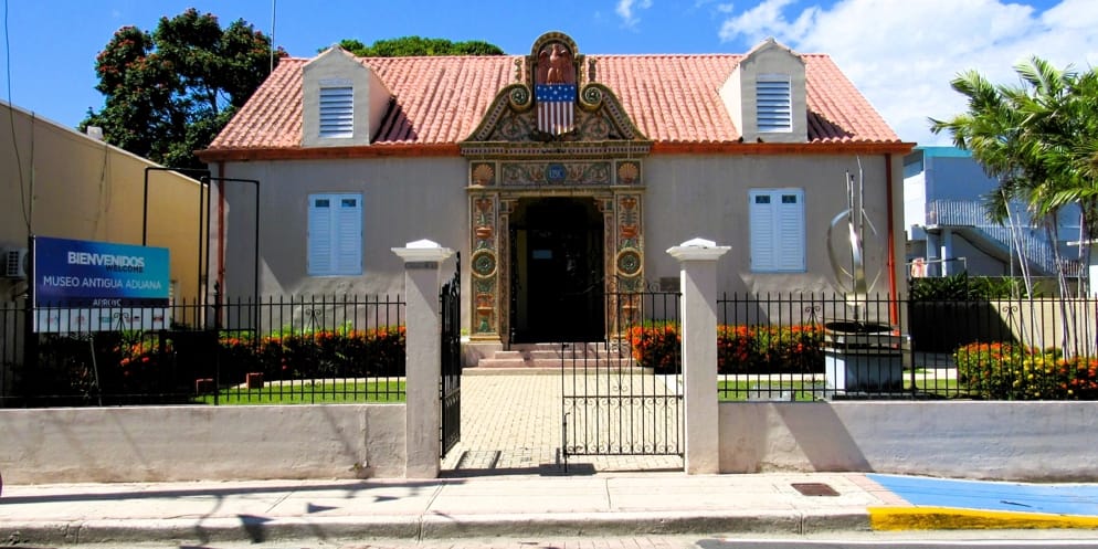
The Museo Antigua Aduana (Old Customs House Museum) and the Teatro Renacimiento (Renaissance Theatre) stand opposite each other on Calle Morse, in representation of Arroyo's past.
Museo Antigua Aduana
|
|
Museo Antigua Aduana - with the original decorative work around the entrance door preserved
|
Arroyo had been a port of entry during the 19th century, while under Spanish colonial rule. As with most of the official ports of entry taken over by the U.S. Custom Services, there was a need to provide new facilities to allow the Custom Services to operate properly.
|
|
"The Flow of the Arts" in museum garden
|
|
|
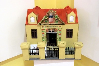
Model of the Old Custom House inside the museum
|
The building which now houses the Museum was constructed in the 1920s as part of a program by the U.S. Customs Services to build new facilities in most of the entry ports that existed in Puerto Rico. Many of the ports of entry from the 19th century were eventually discontinued at some time in the 20th century, including Arroyo, and the customs houses in them were closed.
|
|
One of the exhibition rooms
|
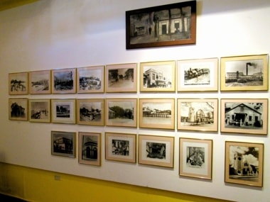
In 1993, the Old Custom House in Arroyo was taken over by the municipal government and refurbished to become a museum and cultural center, as part of the celebrations of the 500th Anniversary of the Discovery of Puerto Rico. This refurbishing project helped to preserve the building and provide a facility that allows it today to be a historical museum of Arroyo, as well as providing space for cultural events and exhibitions.
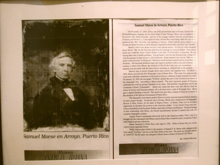
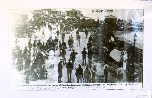
The museum has two permanent collections: one with photo exhibits documenting the arrival of U.S. troops in 1898; the other with personal objects related to Samuel F.B. Morse and his family. Around these, there is also a large number of photos of general interest related to Arroyo's history.
|
|
|
|
Samuel Morse Exhibit
|
|
Extract from "El Nuevo Dia" article on U.S. troops landing in Arroyo in 1898
|
The museum also provides space to display exhibitions on shorter terms, typically showing Puerto Rican artistic works, while the front garden contains the sculpture El Fluir de las Artes by Alejandro Ruiz Figueroa.
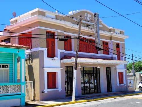
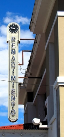
Teatro Renacimiento
|
|
The Renaissance Theatre
|
Arroyo's theatre is located on Calle Morse at the corner of Calle Arizona 7. This was originally built in 1920 by the members of a Production Cooperative and was named Teatro Fausto (Faust Theatre) in honour of the German poet Johan Wolfgang Goethe, author of the poetic work "Faust". In this initial incarnation it hosted great works of operas and zarzuelas as well as presentations by renowned artists.
|
|
El Teatro Renacimiento
|
Sometime later (around the 1940s) the theatre was acquired by Federico Basora, partnered by Juan (Yuyo) Dávila Aldecoa. The partners decided to rename the theatre and ran a public competition to find the new name, which resulted in the birth of Teatro Renacimiento. In this new form it operated as a theatre and cinema for many years.
|
|
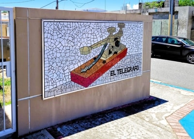
Mosaic "El Telegrafo" next to theatre entrance
|
As with many similar buildings, over time it fell into disuse and deteriorated. The Arroyo municipal government acquired the building with the intent of preserving it, and eventually were able to finance a reconstruction project. As a historic building, the façade was preserved and restored, but the rest of the building was in such bad condition that it was rebuilt as a new concrete and steel structure with the project being completed in 2012.
The modern version of Teatro Renacimiento is used for a variety of activities - graduations, concerts, theatrical works, and cinema as well as being available as a meeting place.
|
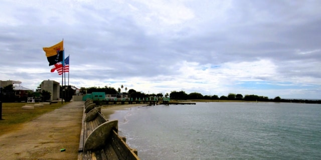
El Malecón
El Malecón (Waterfront Promenade or Boardwalk) has been refurbished in recent years but continues to serve as a focus for gatherings and relaxation in an area highlighting Arroyo's closeness to the sea.
|
|
El Malecón viewed from across the harbour
|
In its modern incarnation it is formally known as Paseo Las Américas and is located between Calle Marina and the sea, till it reaches the eastern end of the harbour.
|
|
|
|
View from the western end of El Malecón towards the centre
|
|
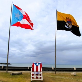
Flags
|
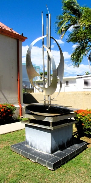
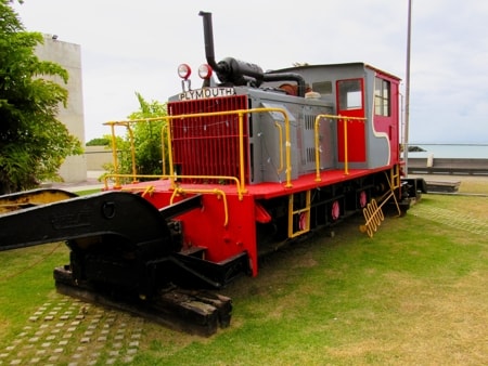
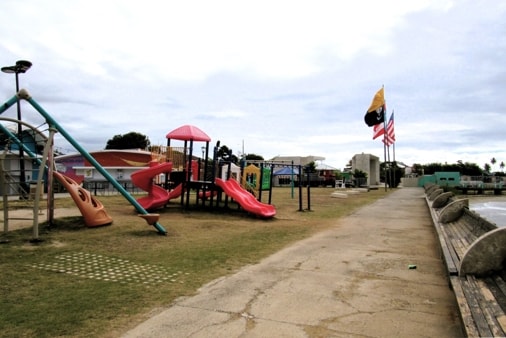
The modern boardwalk has parking on the western side and incorporates a number of kiosks that can house arts and crafts establishments, cafes, bars and restaurants as well as having bathrooms and a performance stage. Visitors can also see the old train engine that is on display and there is a children's playground to keep the younger ones entertained. At the end which intersects with Calle Morse, there is a monument dedicated to Samuel Morse, the man who invented the telegraph and who used it for the first time in Puerto Rico in this municipality.
|
|
|
|
Engine once used at Central Lafayette
|
|
Children's Playground
|
Additional restaurants and bars in the area make this a focus for entertainment in Arroyo. The stage is used to make this an event centre, and traditional activities such as the parades during Fiestas Patronales (Patron Saint's Festival), and Carnival end their routes here.
Samuel Morse Monument
|
|
Looking down Calle Morse towards El Malecón and the monument
|
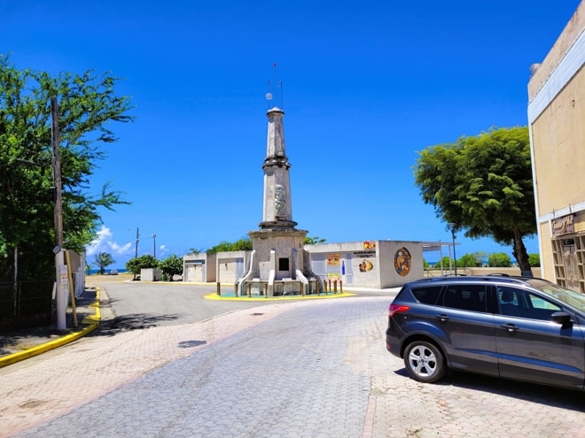
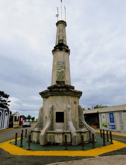
At the bottom of Calle Morse, where it intersects with El Malecón, is a monument dedicated to Samuel F. B. Morse. Amongst a number of plaques located around the base of the monument, the main one tells the story of Morse bringing the first telgraph line to Puerto Rico when he installed it in Arroyo. Another of the plaques contains the "Morse Code" with a list of all the dots and dashes values.
The story of the first Puerto Rican telegraph line:
On the 1st of March 1859, Morse officially inaugurated the first telegraph line in Puerto Rico. It connected the Hacienda Enriqueta, owned by his son-in-law Edward Lind in the Concordia sector, with Lind's business office and warehouse at Playa Arroyo (Arroyo Shore), today El Malecón.
Oral fokelore has it that when Morse came to visit his daughter Susan, he saw that the route between the hacienda and the warehouse was a long one; he recommended that they install a telegraph line to facilitate communication and they agreed. (It should be noted that while telegraph systems already existed,
|
|
Monumento Morse
|
Morse invented the version which uses a single transmission line and was therefore the prime mover of this new technology.)
The day before the inauguration of the telegraph line, Morse was with Edward Lind in the warehouse at the Shore, coordinating the last details. Their carriage was close to them when some sailors passed by, laughing and talking loudly. The horses became startled by the sailors and began a mad race down the main street, which at that time was named Isabel II.
Fearing a greater mishap, Morse had to warn the people at the hacienda, but that would alter the novelty of the first message. He had to act quickly and had no choice but to warn them by telegraph. With much thought, Morse wrote the message: "Horses escaped from here coming in your direction. Stop them." His daughter Susan knew the code and took the message. They were able to stop the carriage, avoiding a serious accident, and this became the first telegraphic message sent in Puerto Rico.
The official inauguration went ahead as planned on March 1, with Morse sending the message: "Puerto Rico, beautiful jewel! When you are linked with the other jewels of the Antilles in the necklace of the world's telegraph, yours will not shine less brilliantly in the crown of your Queen!".
|
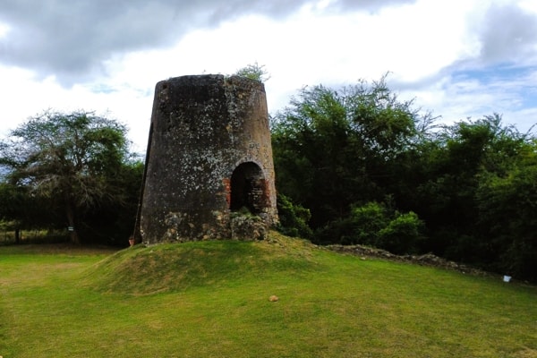
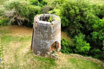
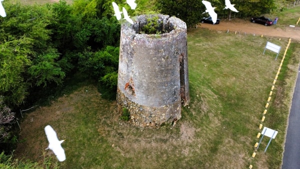
El Molino de la Berbedera
|
|
El Molino de la Berbedera
|
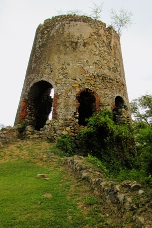
If you take the local road towards the lighthouse at Punta Figuras, on the way you will find an interesting ruin at the side of the road before reaching El Faro.
Built around 1850, this was the Molino de Viento ( Windmill) used to grind sugarcane at the Hacienda Milagros. The Molino is all that now remains of this sugar plantation.
|
|
El Molino
|
|
|
Sea birds showing an interest in the ruins
|
|
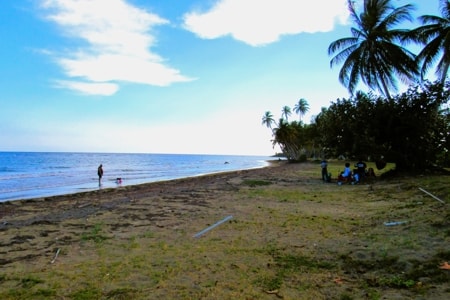
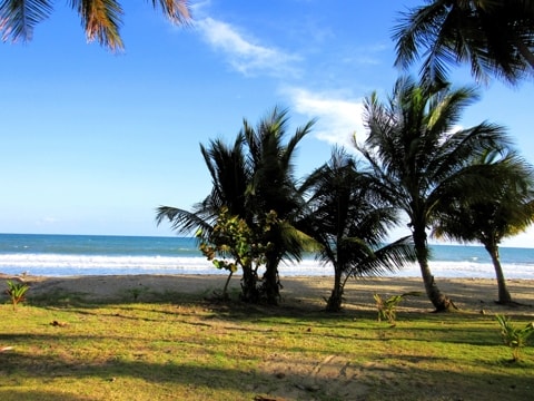
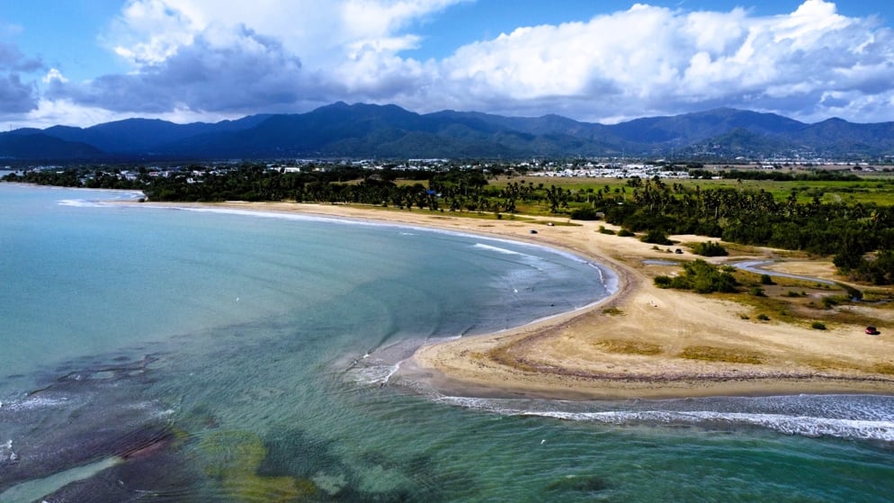
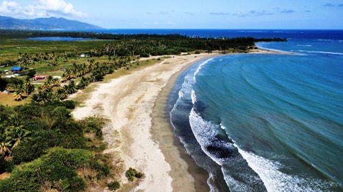
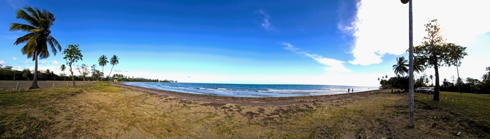
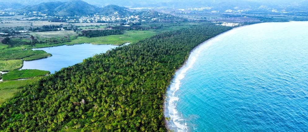
The Beaches of Arroyo
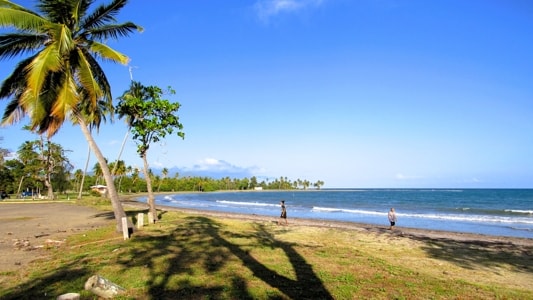
Not surprisingly, as the urban area of Arroyo lies hard up against its border with Guayama, all its beaches are to its eastern side. Arroyo has an unbroken stretch of beaches from the harbour to its eastern border with Patillas.
Playa del Faro
|
|
Playa del Faro
|
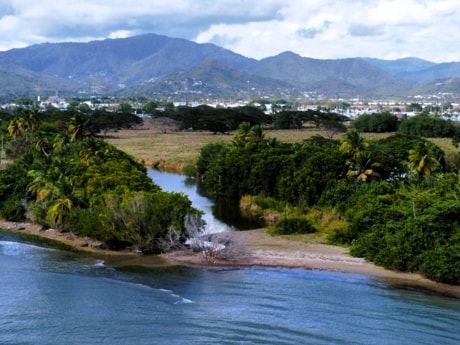
Playa del Faro, (Lighthouse Beach), stretching from the mouth of Río Nigua to Punta Figuras (Figuras Point) The beach is named for the lighthouse (El Faro>).
|
|
The Nigua river mouth at the western end of Playa del Faro
|
The wide sandy beach curves gently from the river mouth to Figuras Point.
|
|
Looking eastwards over Playa del Faro
|
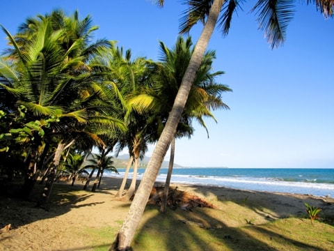
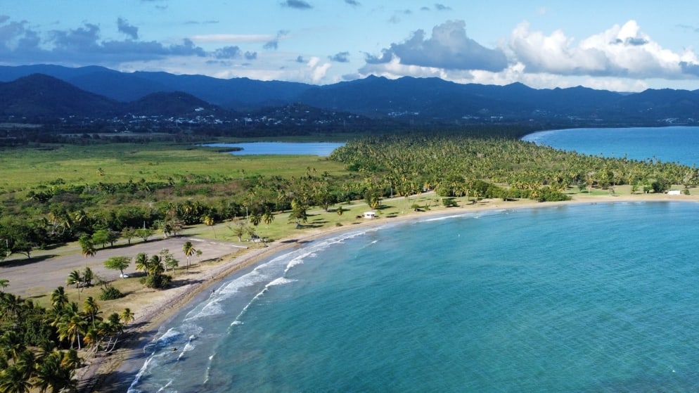
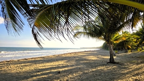
"Chiriopolis"
|
|
Chiriopolis
|
Chiriopolis, known formally today as Balneario de Punta Guilarte is Arroyo's largest and best know beach. It runs from just East of the lighthouse and curves round until it reaches Guilarte Point (Punta Guilarte). A sandy beach with plenty of shade under the trees, the western end is bordered by the Punta Guilarte Vacation Center.
|
|
Chiriopolis Beach
|
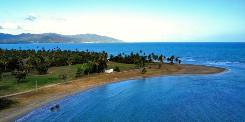
Punta Guilarte
A small beach that continues on from Chiriopolis, finishing the long curve that stretches to Punta Guilarte (Guilarte Point). On the other side of the point the land curves back inwards to become Palmas Beach.
|
|
|
|
|
|
Playa Punta Guilarte
|
|
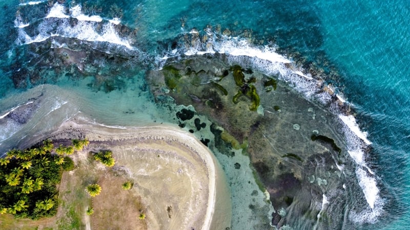
Punta Guilarte is protected from the stronger waves rolling in from the Caribbean Sea by reefs which can be seen in the photo showing an aerial view, with the waves crashing offshore onto the reef.
|
|
|
|
|
|
Punta Guilarte and its surrounding reef
|
|
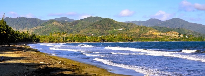
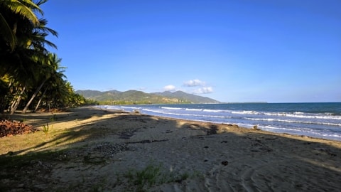
Playa Las Palmas
Palmas Beach lies East of Punta Guilarte and continues on an eastward curve to the border with the town of Patillas.
|
|
Playa Palmas
|
|
Palmas Beach in front of the resort condominiums at the Patillas end of the beach
|
|
|
A view to the West
|
|
|
Looking East towards Patillas
|
|
Other Views Around Arroyo
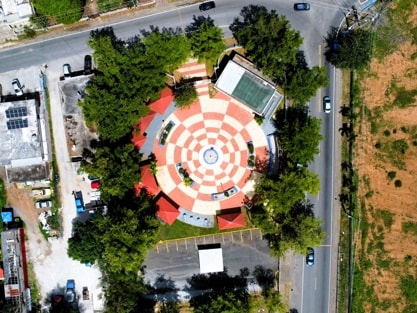
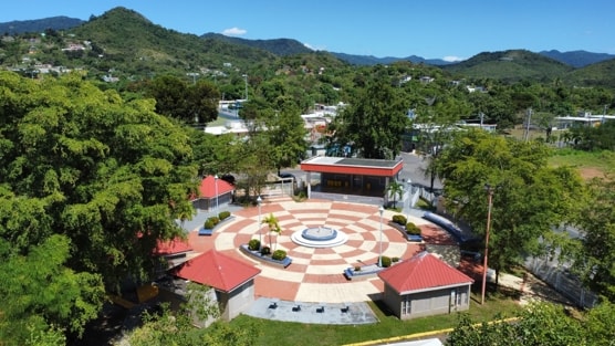
Plaza de Recreo in Barriada Marín
|
|
|
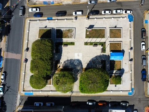
Barriada Marín, in barrio Pitahaya, lies North of the downtown area of Arroyo. It has its own small but pretty plaza de recreo, at the corner where Road #753 turns West at its intersection with Road #755.
|
|
|
The plaza viewed from overhead.
|
|
|
|
|
Looking accross the plaza towards the mountains to the North.
|
|
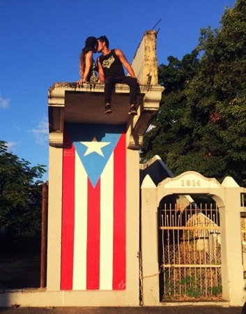
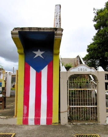
Bandera de Hector
|
|
OriginalPhoto Source: Hector PR - Facebook
|
|
|
The current flag
|
The original flag painted in Arroyo by Hector Collazo as part of the "78 Pueblos 1 Bandera" project is shown in the left image. This is clearly not the flag that can be found today at the same location. The current flag has different colours, and at the top it is extended onto the ceiling and, at the bottom, down to the pavement.
It is not clear what happened to the original, though most of the neighbouring towns in the southeast of Puerto Rico lost their editions of the Bandera de Hector because of hurricane Maria, when she entered through this section of the island in 2017.
|
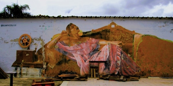
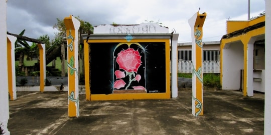
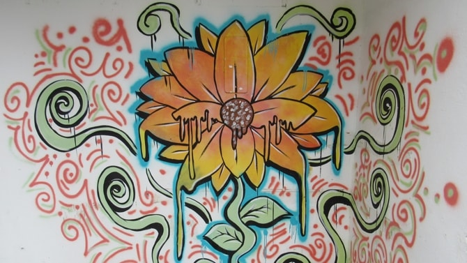
Urban Art
In the area close to the location of the Bandera de Hector in the downtown part of town, and visible from El Malecón, a number of abandoned building and empty lots have been brightened with Urban Art.
Various interesting murals cover walls, as well as other painted areas bringing colour to fill out otherwise drab areas.
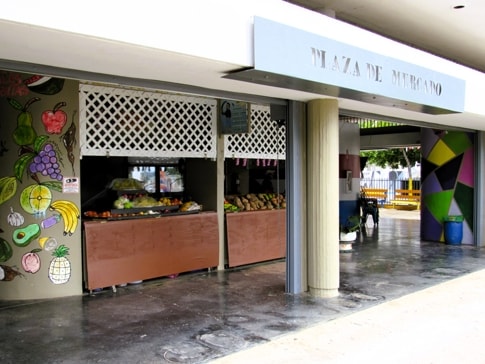
Plaza de Mercado
The Plaza de Mercado (Marketplace), at the corner of Calles Principal and Morse, backing onto Arroyo's fire station.
|
|
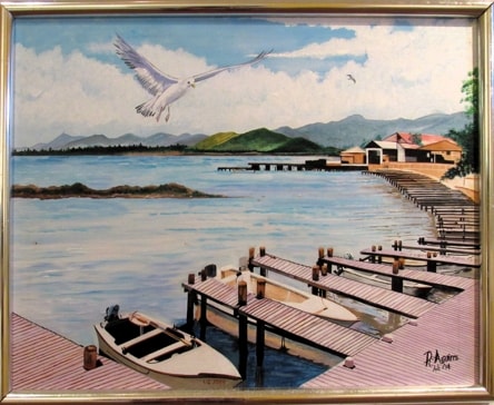
The Harbour
A view looking West over the harbour and El Malecón, painted by R Aguirre and on display at the Museum.
|
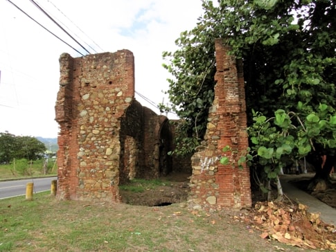
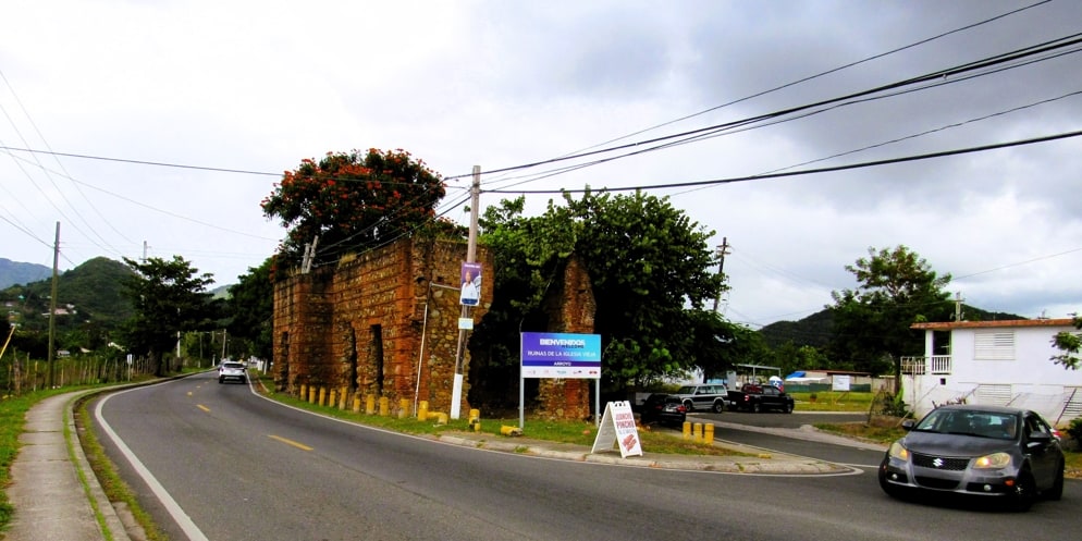
Iglesia Vieja
|
|
Iglesia Vieja
|
|
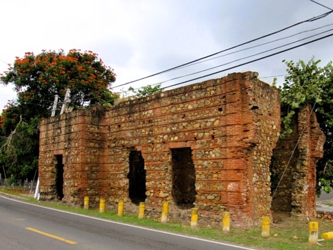
When driving North on Road #753, away from downtown Arroyo, at the turnoff to the Valles de Arroyo neighbourhood we encounter the ruins of Iglesia Vieja. While called Iglesia Vieja (Old Church), these ruins are not really those of a church.
It was really a family chapel built by a local landowner, to have a place to bury family members and for personal prayer.
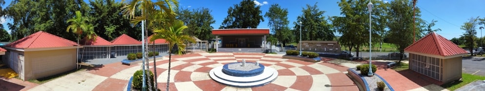
Plaza de Recreo Pintor Samuel Morse
|
|
|
|
|
The plaza de recreo is another part of Arroyo dedicated to Painter Samuel Morse, for his part in the history of the town.
|
|
|
|
|