|
|
Aguada
Aguada, situated in the northwest part of Puerto Rico, is one of the oldest Spanish colonial settlements on the island, and lays claim to being the landing site of Christopher Columbus when he discovered the island in 1493.
|
|
Welcome to Aguada
|
Juan Ponce de León (first governor of the island), having established his capital at Caparra, ordered Cristóbal de Sotomayor in 1510, to start a second settlement at "los puertos de los pozos de Aguada" (the port of the wells of Aguada). So, Sotomayor created a village somewhere in this area under the name of the Villa de Sotomayor (Sotomayor's Town). This initial settlement, however, did not survive for very long as it was burned down by Tainos in 1511, with most of its inhabitants perishing in the attack. The survivors managed to escape back to Caparra to report the tragedy to Ponce de León.
Some time later a group of Franciscan monks build a monastery in the Espinar area which survived for some time but also disappeared under Indian attacks. It was towards the end of the 16th century before a more successful settlement was established under the name San Francisco de Asis de la Aguada. In 1692, by royal decree, the town of San Francisco de la Aguada for formally recognized and the church was established as an independent parish.
The name, Aguada, was derived from the fact that ships traveling between Spain and the colonies in the Americas stopped to take on water (Agua) from various wells close to the beaches here. In 1737, another royal decree mandated that all mail from the island destined for other colonies be sent to Aguada for collection by ships heading from Spain, further underlining the importance of the town.
At this time, Aguada covered a significant area comprising most of the northwest of the island. As in other parts of Puerto Rico, as the population grew and dispersed through the region, areas within the town established their independence from the original municipality. Pepino was separated in 1752, followed 20 years later by Santa Rosa del Rincón and in 1780 the town of San Carlos de la Aguadilla was founded and so on, so that Aguada gradually adjusted its land area to what is recognised today.
As part of the celebrations to mark the 400th anniversary of the landing of Christopher Columbus in Puerto Rico, in 1893 a monument (the Cruz de Colón) was erected on the banks of the Culebrinas River. At that time, it was attributed to being in Aguadilla, however in 1948 when the Planning Board approved Aguada's planning zones, it attested that the area of the monument was part of barrio Espinar in Aguada.
Over the years, Aguada has suffered a number of setbacks from earthquakes, hurricanes and other disasters which have destroyed property and taken lives. Most notably the 1918 earthquake which destroyed numerous houses and other buildings including the parish church and the Cruz de Colón monument at Río Culebrinas. Aguada has come through all of these, survived, and rebuilt.
|
Parroquia San Francisco de Asís
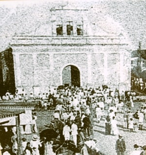
There have been earlier churches in Aguada, but the first dedicated to St Francis of Assisi (San Francisco de Asís) was built between 1585 and 1587. As in many parts of Puerto Rico, this was probably a wooden building and was used to hold services a few times a year when priests visited from the home parish of San Germán.
|
|
Parroquia San Francisco de Asís
|
In 1692, a masonry building was constructed when the parish was created by royal decree independently of San Germán. The Aguada parish became the Vicarage of Northwest Puerto Rico and is one of the oldest on the island.
|
|
Parroquia San Fransisco de Asís
|
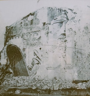
The church building was neoclassical and went through various reconstructions over time, with the last known to be in 1828. This building survived into the 20th century when it was destroyed by the 1918 earthquake.
|
|
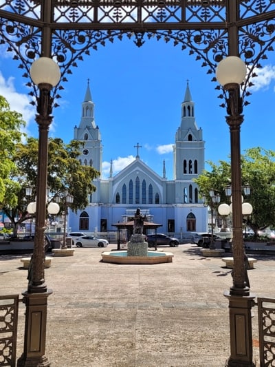
San Fransisco de Asís viewed across the Plaza
|
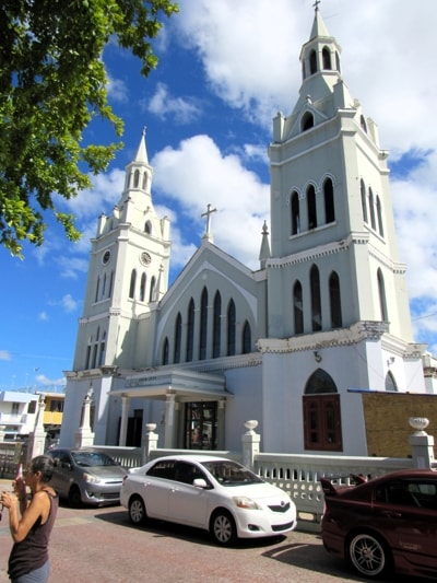
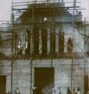
Father Pedro de Arancibia, while the parish priest also had a background in architecture, was named in 1919 as the architect responsible for the construction of a new church. The cornerstone was laid in 1922 and work to construct the new church took place from 1924 to 1936, with a significant delay caused by the major hurricane San Felipe which affected the island during this period.
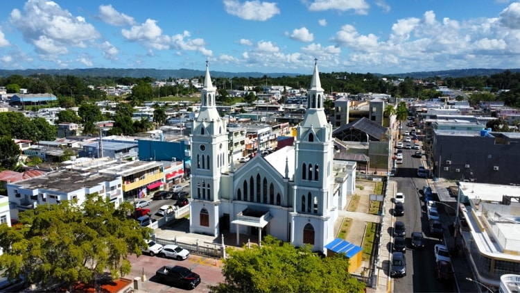
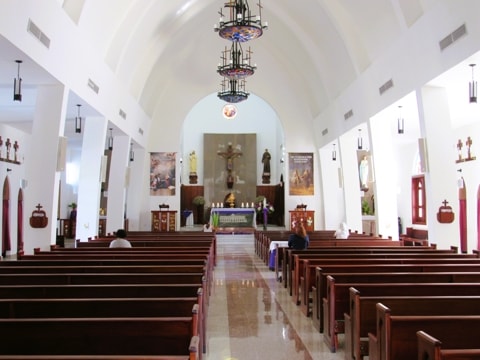
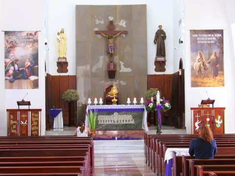
This new church is the one you see today, of neogothic, cathedral style in Latin-cross form with ogive arches forming the vaulted ceiling, and more than 20 stain-glass windows. Its twin towers are 100ft tall, making them unique in Puerto Rican churches, and making views of the church from any direction quite spectacular. The cupula above the altar and the catacombs were retained from the original building.
|
|
|
|
|
|
Original Church c.1890 Photo Source: Municipio de Aguada
|
|
1918 after the earthquake Photo Source: Municipio de Aguada
|
|
Rebuilding started in 1924 Photo Source: Municipio de Aguada
|
The actual stain glass windows were added in 1956 and brought from Leon in Spain. In 1964 the central part was remodeled, originally made of wood and now it is made of concrete, in ogive. The result today is a church which is considered the jewel of Puerto Rican religious architecture.
This "new" church is now 100 years old, but the parish has existed for more than three centuries. In that time, it was the mother church overseeing the development of parishes in Aguadilla, Rincón, Añasco, Moca, San Sebastían and Isabela.
|
|
|
|
Interior from inside the entrance door
|
|
Interior view closer to the altar
|
|
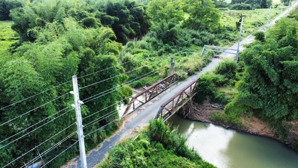
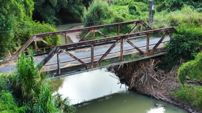
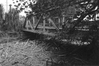
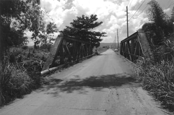
Puente Coloso
While no longer in use, and closed to traffic due to its deteriorated condition, The Coloso Bridge is a historic landmark in Aguada and was added to the National Register of Historic Places in 2010. Built in 1928 by the Central Coloso sugar refinery to improve access to the Central for the transportation of sugarcane from the cane fields in Aguada and surrounding areas.
|
|
The Coloso Bridge over the Culebrinas River
|
During the 19th century, the Central Coloso in Aguada had developed into a major sugar refinery which brought in sugarcane from not only its own lands surrounding the refinery, but also from farms of many independent growers in the region. Transportation of cane from the farms to the refinery became a key factor in maintaining the efficient operation of Central Coloso.
By 1893 the Compañia Ferrocarrilera de Puerto Rico (Puerto Rico Railway Company) had linked the towns of Aguadilla, Aguada, Rincón, Añasco, Mayagüez and Hormigueros by construction of a 55 kilometers long railway (Line C - Aguadilla-Hormigueros). This railway passed by the Central Coloso (Aguada) and Central Córcega (Rincón) before reaching the municipality of Añasco. The existence of this railway became an significant part in transportation of sugarcane to the Centrales, but more was needed and Coloso, like many other mills and refineries, added its own narrow gauge railway that ran right into the refinery from the sugarcane fields.
|
|
Coloso Bridge as seen today
|
The Puente de Coloso (Coloso Bridge) was built in 1928 by Central Coloso as part of that company's private railway system. The railway system connected the refinery directly with the agricultural lands in the Guanábano and Espinar barrios in northern Aguada, close to its border with Aguadilla. This truss bridge is the largest extant bridge associated with this system.
|
|
The Bridge as it looked in 2010
|
Roadway was also used that ran parallel to the Guanábano-Espinar section of the railway. The steel bridge was designed to support both train and vehicular traffic across the Culebrinas River. The Guanábano-Espinar route had its northern end just south of the town of the Old Victoria Hacienda in Aguadilla. At Victoria the private railway connected with the American Railway of Porto Rico and the roadway connected with Highway #2.
The company's railway was used to transport cane from nearby farms in the Coloso Valley to the refinery, while motor trucks and the American Railway of Porto Rico brought in cane from areas outside the route of the company's railway. Motor trucks were also used in the opposite direction, to transport the processed sugar from Central Coloso to the nearby coastal port city of Aguadilla.
|
|
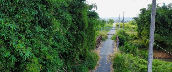
The bridge carried its traffic all the way down Road #418 to Central Coloso
|
As the Department of the Interior began a program to improve the roads and highways on the island to make them more suited to motor transport, the motor trucks began to carry more and more. By 1942 the volume of sugarcane brought to Central Coloso by truck had grown to almost equal the volume carried by its railway. By the time the refinery's production began reaching its peak in the 1950s, trucks had become the dominant means of transportation.
|
|
In 2010 the road to the Central was still open
|
When the American Railway Company of Puerto Rico ceased operations in 1953, the private railways of the sugar refineries throughout Puerto Rico lost their importance, including that of Central Coloso. The railway track was removed, and Coloso Bridge became part of Road #418 in 1956, still playing a vital part in the movement of sugarcane into the refinery. The bridge remained a part of the transportation network around Central Coloso until the early 21st century when the refinery ceased operations.
The Puente de Coloso, as a Warren with vertical truss bridge, is considered unique on the Island. The Puerto Rico Road and Public Works 1995 Bridge Survey observed the importance of this bridge's deck stringers that were designed for both vehicular and railway traffic. The structure employs "diagonals to carry both compressive and tensile forces, verticals serve as bracing for the triangular web system". The truss structure is 25.93 meters long and rests on two concrete abutments 3 meters over the Culebrinas River.
The fact that the Coloso Valley was declared an agricultural reserve has prevented development in the area so, while the bridge may be showing its age, it is still in place to remind everyone of its place in history.
|
Central Azucarera Coloso
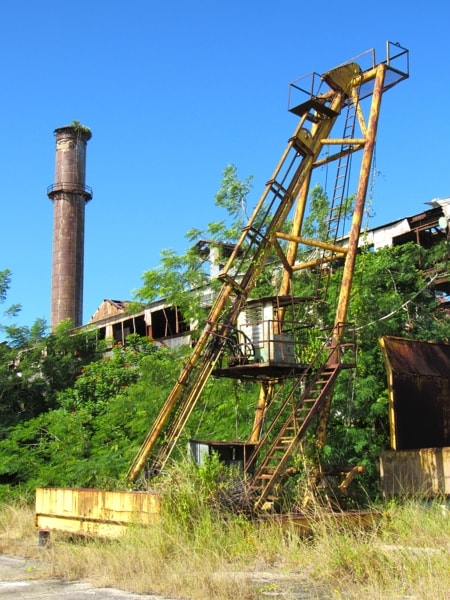
The Central Coloso sugar refinery was one of the largest in Puerto Rico and the last to close down in 2003. While it has now worn down and only ruins remain, it still presents an impressive reminder of when Sugar was king in Puerto Rico.
|
|
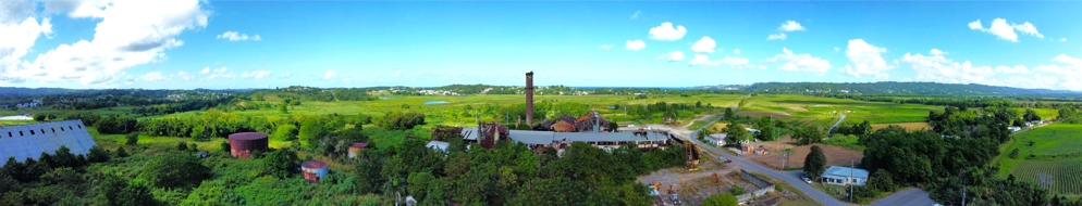
Panoramic view of Central Coloso from the South
|
The Central Azucarera Coloso (Coloso Sugar Refinery), located in the Guanábana barrio of Aguada, was one of the earliest sugar refineries to be founded in Puerto Rico and, during the 20th century, it grew to be the largest on the island. It was also the last of the Centrales to close when it ceased operations in 2003.
The creation of Central Coloso goes back to the end of the 1820s, when the hacienda Caño de las Nasas was founded on the outskirts of the town of Aguada. This sugarcane plantation processed its cane using a mill powered by oxen, and by 1864, produced about 100 barrels of muscovado sugar (raw sugar) per day. At the end of the 1860s, Emilio Vadí acquired the hacienda and changed its name to Coloso. It became a refinery in 1875, when Vadí mechanized the milling and raised production to 1,000 barrels of sugar per day. During the remainder of that decade, production continued to grow.
|
|
Central Coloso
|
In 1879, Vadí formed a partnership with the German businessman H. Kuster, but the operation's large debt and the crisis in the sugar industry in the last third of the nineteenth century, force them to sell Coloso to José Amell Massó in 1897. Between 1885 and 1895, Massó had acquired a number of haciendas and refineries which he now consolidated into Central Coloso, including the transfer of machinery from the other locations which resulted in a growth in Coloso's refining capacity.
As a result of the consolidation, the Coloso Refinery and its lands stretched across 4,500 acres, of which 500 to 600 were planted annually. Production was further augmented as it began processing the sugarcane from other growers in the region, so that by 1902 a total production of 20,000 bags of sugar was recorded.
In 1904, French investors acquired the Central Coloso and incorporated it under the name Sucrerie Centrale Coloso de Porto Rico. It passed into US hands in 1915, when it was purchased by the West Puerto Rico Sugar Co., which was renamed in 1921 as, "Central Coloso, Inc.". The plant continued to grow and by 1952, a year of record production in the Puerto Rican sugar industry, Coloso had a milling capacity of 5,000 tons of sugar per day and reached its peak in 1961.
The sugar industry went through a major economic crisis in the mid-20th century due to several reasons, including rising production costs, significant drops in the selling price of sugar, as well as restrictions on credit, and strikes. This coincided with the increase in industrialisation of the island, which resulted in the displacement of agriculture from its position as the main sector of the island's economy.
|
|
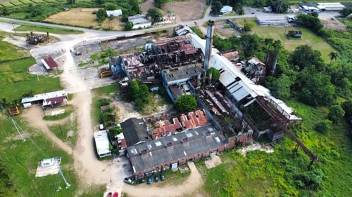
Looking down on Central Coloso from the West
|
The Coloso plant continued to be managed by private industry until 1972, when the Government of Puerto Rico leased it as part of the Sugar Industry Rehabilitation Program (PRIA), which had begun to be implemented in 1970. In 1976, the government acquired the Central Coloso through the Puerto Rico Sugar Corporation, which had been created as a public corporation in 1973 with the purpose of developing, improving and intensifying the cultivation and processing of sugarcane. The plan was for the corporation to be in charge of managing the plant while leasing the land to sugarcane growers. The harvest they produced would then be processed at the plant.
By the 1980s, most sugarcane refineries in the island had shut down operations. Coloso maintained a considerable production tonnage compared to the plants that remained in operation but, despite the government's efforts, the industry was in an increasingly critical state. Beginning in 1986, all sugarcane production managed by the Sugar Corporation passed into the hands of private hands, with most of this production being processed at Coloso.
|
|
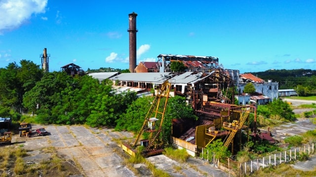
Central Coloso
|
In the early 1990s, the government began implementing a plan to privatize the Sugar Corporation. The result was that by 1997, only two plants remained in operation - Roig in Yabucoa (which closed the following year), and Coloso.
In that same year, a transition committee was formed by the corporation and sugarcane growers with the result that between January 1998 and December 2000, the plant and land of Coloso was transferred to the growers. In private hands, Coloso continued a limited processing of sugarcane until 2003, when it finally ceased operations, bringing to an end the era of Puerto Rican sugarcane.
Footnote - In 1999, PR Law No. 275 of 18 August of that year declared the former industrial complex of the Central Coloso a monument of historical value. The following year another law made the whole valley in which Coloso is located an agricultural reserve to prevent the area being developed for other purposes.
|
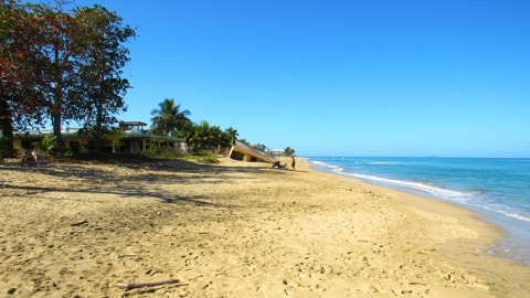
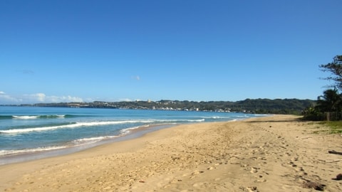
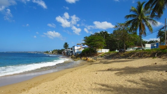
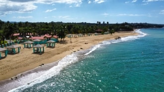
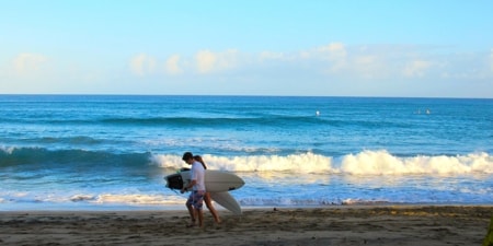
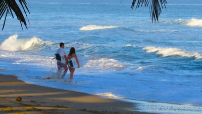
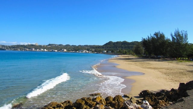
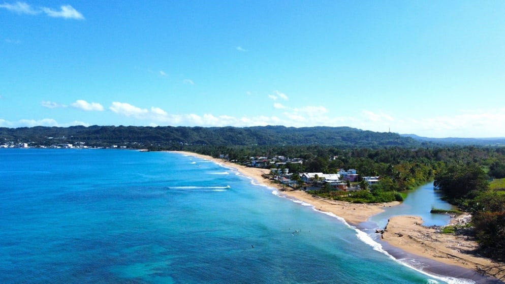
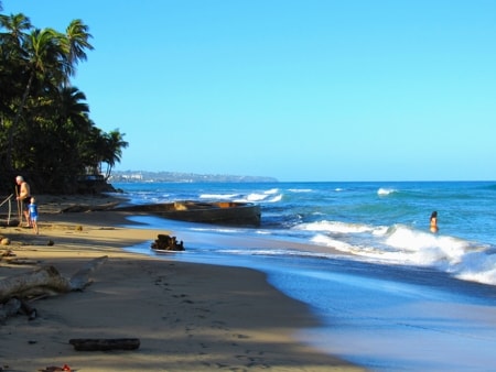
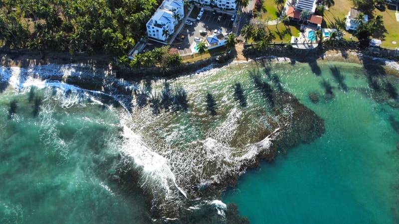
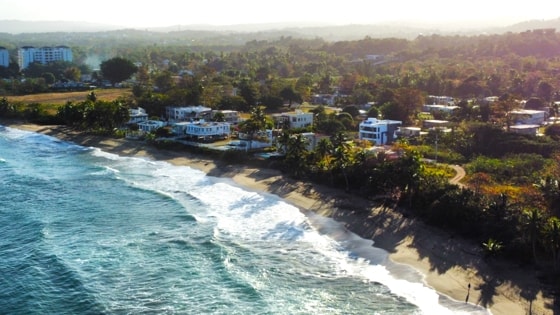
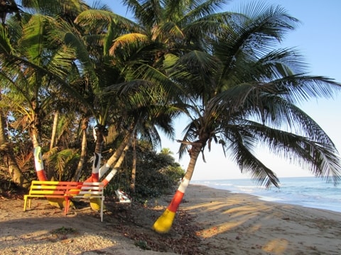
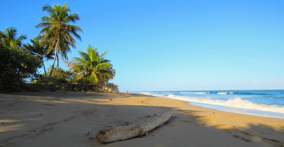
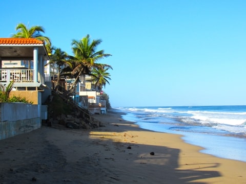
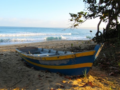
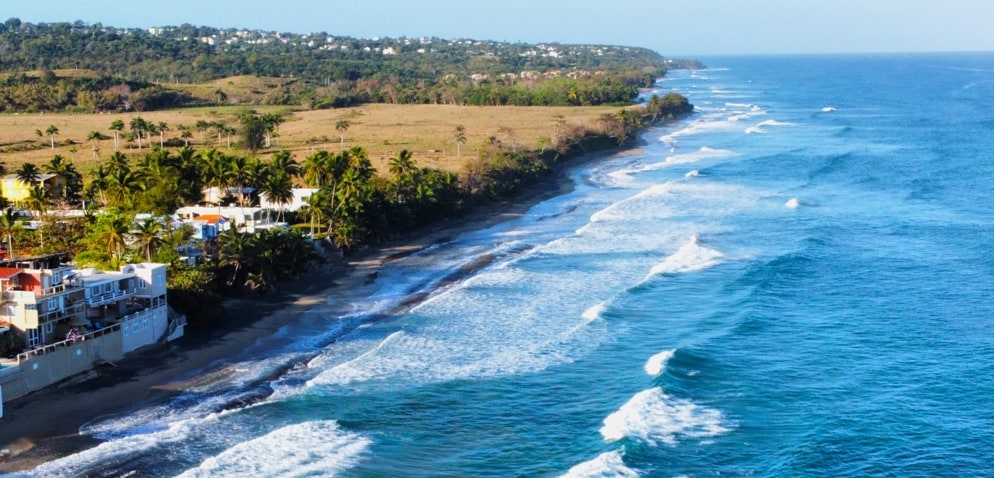
The Beaches of Aguada
From its northern border with Aguadilla, the coast of Aguada stretches to the South around bays and river mouths untill it reaches the border with Rincon. This coastline seems to be one long beach going on forever, but each stretch has its own name and character and a number of other interesting feature beyong the sand, sun and water. The following is a view of various beaches on a run down the coast from North to South.
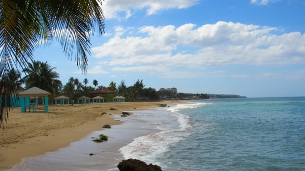
Playa Parque Colón
|
|
Columbus Park Beach
|
Playa Parque Colón, (Columbus Park Beach) is located as far North as one can go in Aguada, right on the border with Aguadilla. In fact it can only be reached by road from Aguadilla with the southern end of the beach running along the mouth of the Caño Madre Vieja (Old Mother Channel.)
|
|
Columbus Park Beach from the southern breakwater
|
The beach fronts a park which is named after Christopher Columbus, hence the beach's name. The park was constructed by the Puerto Rico Reconstruction Administration in 1937, under President Franklin D Roosevelt's New Deal.
|
|
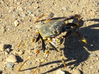
A local beach resident
|
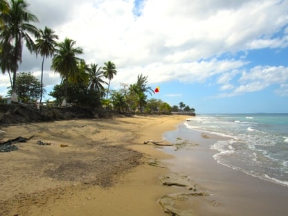
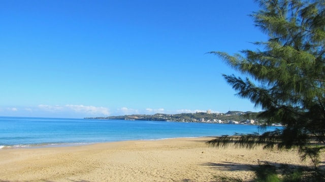
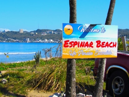
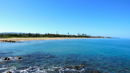
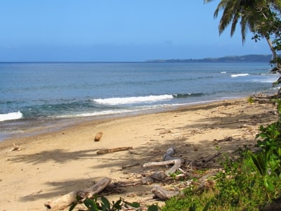
Playa Espinar
|
|
|
|
Playa Espinar
|
|
Espinar Beach from the breakwater at the southern end of Playa Colón
|
Playa Espinar, named after the barrio in which it is found. This beach runs from the southern side of the Caño Madre Vieja, below Playa Parque Colón, and continues down to the mouth of Río Culebrinas.
|
|
The southern end of the beach with the mouth of Río Culebrinas to the right
|
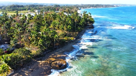
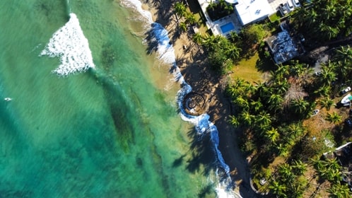
Playa Cañones
Cannons Beach (Playa Cañones) is named for the remains of World War II cannons which were installed here to help defend the coast, the entrance to the Caribbean Sea, the route to the Panama Canal and the air base just to North in Aguadilla. Originally a set of 6 guns were installed on Panama gun mounts, of which the bases of three can still be found on or near this beach.
|
|
Playa Cañones
|
In one of the aerial photos here which looks straight down, one of the cannon emplacements can be seen clearly on the beach where it is washed by the waves.
|
|
Looking South
|
Slightly lower down and to the right, a second emplacement can be seen set a bit back from the beach itself and somewhat overgrown. The third is close bye, but hidden by the vegetation.
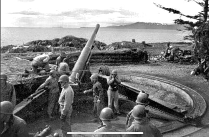
A photo from the 1940s shows what one of these cannon emplacements looked like during a firing excercise. With its gun mounted on its circular track it could be turned through 360°s to bear on its target and provide a wide coverage range.
|
|
|
|
Aerial view showing two of the cannon bases
|
|
c.1940 showing one of the guns in placePhoto Source: callejeandopr.com
|
A fairly narrow, sandy beach which is best visited at low tide, it at times shows signs of "black sand" which can be found on a number of beaches in Puerto Rico. The remains of the cannon installations adds character to this small beach.

|
|
Looking northwards over the beach
|
Table Rock Beach
|
|
Table Rock Beach
|
A small beach which is just South of, and around the corner from, Playa Cañones.
The beach takes its name from a flat, rectangular rock formation just offshore which is visible at low tide, and shallowly below the water's surface when the tide is in. These rocks resemble a table set up at the beach's edge.
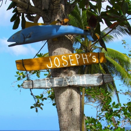
Joseph's Beach
|
|
Welcome to Joseph's Beach
|
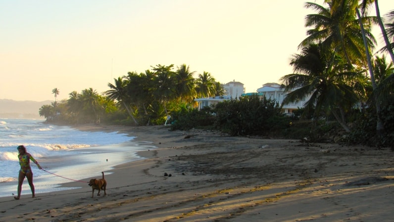
Continuing southward down Aguada's coast brings you to Joseph's Beach. A small, sandy beach right next to the coastal road which overlooks it.
|
|
Joseph's Beach
|
|
|
A view northward over Joseph's Beach
|
Artist's Beach
|
|
Artist's Beach
|
Artist's Beach is found just before reaching the Malecón de Aguada (Aguada Promenade) in Guaniquilla. Hard up against the coastal road and a little below it, this is another pleasant, sandy beach.
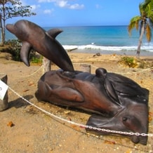
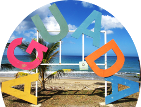
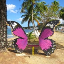
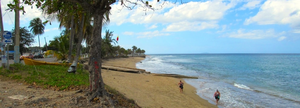
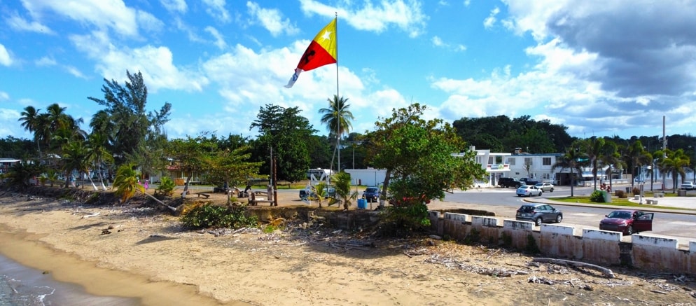
Playa Guaniquilla y El Malecón
|
|
Guaniquilla Beach and Promenade
|
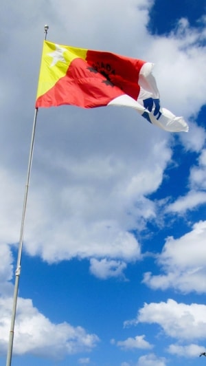
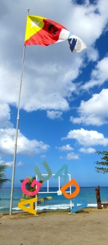
Just where PR Road 441 from the downtown area of Aguada meets the coastal road is the Malecón (Promenade). Overlooking another sandy beach (Guaniquilla Beach), the the centre of the Promenade contains the Letters of Aguada arched below the town's flag.
To one side of the flag and Letters, in an area below the palm trees, is a display of works from local artists and artisans (Artisanos de la Costa), while directly across the road is a small plaza dedicated as a historic sanctuary and holding the Monument of the Columbus Cross (Monumento Cruz Colón).
Balneario Pico de Piedra
|
|
Pico de Piedra Beach
|
As a balneario (public beach), Pico de Peidra has facilities not found on the other beaches in Aguada. This includes a dedicated parking, gazebos on the beach to provide shaded sitting areas and restaurants close by. A beautiful, sandy beach providing a wonderful location to enjoy the ocean.
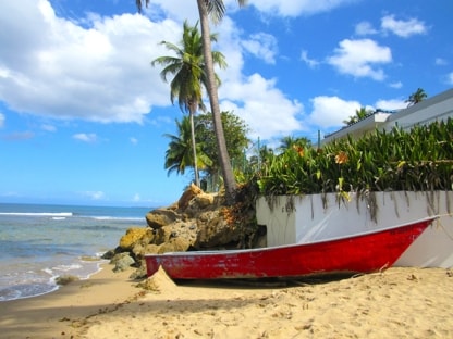
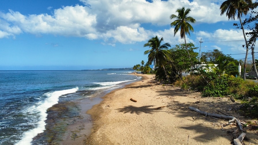
Playa de Lohans
|
|
Lohans Beach
|
Continuing down from Pico de Piedra, across the Guayabo River and Santi Ponce Channel, we find picturesque Lohans Beach. A curving, sandy beach with shady trees bordering much of its length.
|
|
Playa de Lohans
|
|
|
Looking northwards
|
|
|
|
|
Shade under the palm trees
|
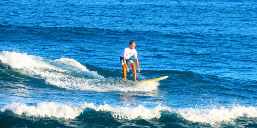
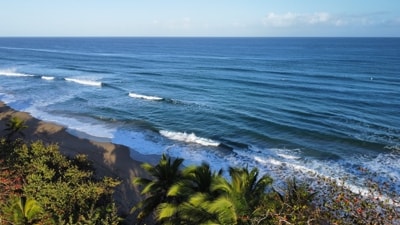
While not generally listed as a surfing spot, Lohans does provide enough waves to encourage some surfers to try it out.
|
|
Playa de Lohans
|
Playa Río Grande
Continuing on from Lohans Beach, the coastline stretches westward to reach the mouth of the Río Grande river which forms the boundary between Aguada and the town of Rincón. This last beach in Aguada is Playa Río Grande.
|
|
|
|
Playa Río Grande
|
|
|
Looking along the beach, down to the mouth of the Río Grande
|
|
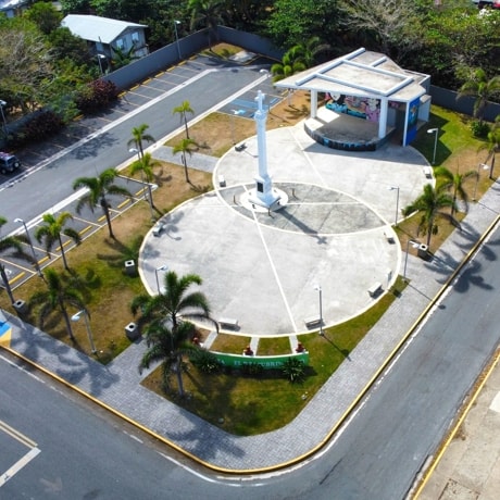
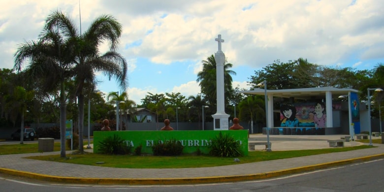
Santuario Historico del Monumento Cruz Colón
A small plaza in Barrio Guaniquilla, set at the corner of the intersection of the coastal road with Carretera Carrizales, and just across from Guaniquilla Beach, is the Historic Sanctuary of the Columbus Cross Monument (Santuario Historico del Monumento Cruz Colón). Dedicated in 1928, originally just a monument in a small park to replace the 1893 original cross, over time it has been expanded and developed into the plaza one can see today.
|
|
Santuario Historico del Monumento Cruz Colón
|
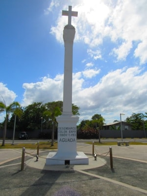
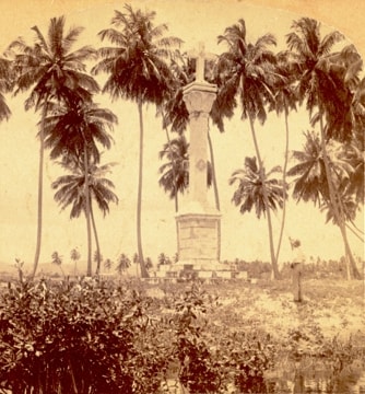
The original Monumento Cruz Colón was erected on the left bank of the mouth of Río Culebrinas (Culebrinas River) in 1893, to celebrate the 400th anniversary of Christopher Columbus's discovery of Puerto Rico on the 19th of November 1493, during his second voyage.
|
|
Monumento Cruz Colón
|
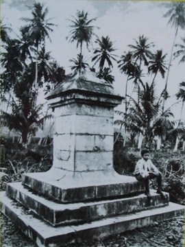
This original Columbus Cross Monument was destroyed by the 1918 earthquake, which had devastating effects on much of the western part of Puerto Rico.
The Liga Patriótica de Aguada (Patriotic League of Aguada) took the lead in the late 1920s, to reconstruct the monument. It acquired a plot of land in Barrio Guaniquilla and paid for the design and construction of the new monument. In 1928, the replacement Cruz Colón was inaugurated in Guaniquilla. The design was by master ceramist Francisco Sánchez and was build by master artisan Diego Sánchez, both natives of Aguada.
Later, in 1933, the Patriotic League donated the monument and park to the municipality of Aguada.
|
|
Original monument on banks of Río CulebrinasPhoto Source: Library of Congress
|
|
|
After 1918 earthquakePhoto Source: Municipio de Aguada
|
In the 1960s, through the initiative of the History and Culture Committee of the Club Aguadeño del Area Metropolitano (Metropolitan Area Club of Natives of Aguada), funds were collected for improvements and beautification of the monument and the park. This work was carried out and the area was redesignated as a historic sanctuary in order to help with its preservation.
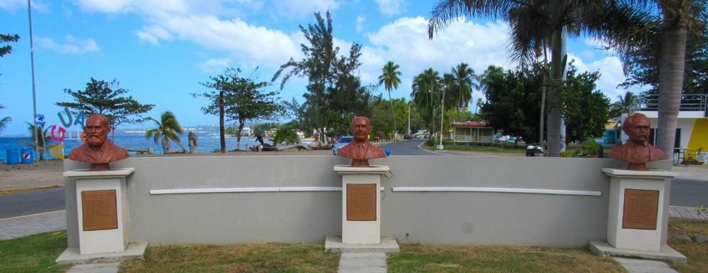
Further efforts were made by the History and Culture Committee of the Club Aguadeño del Area Metropolitano between 1989 and 1991. This resulted in the construction and placement in the park of the busts of three men recognised for there efforts in defense of Aguada's place in Puerto Rico's history.
|
|
Santuario Historico del Monumento Cruz Colón
|
Today the Santuario Historico del Monumento Cruz Colón is a small but beautiful plaza with the monument at its centre.
At the northwest corner a wall curves round, with the name of the sanctuary on the outside and sheltering the three busts on the inside that honour men who did much to support the historic fact that Columbus landed in this area in 1493.
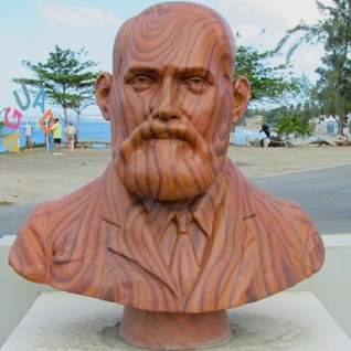
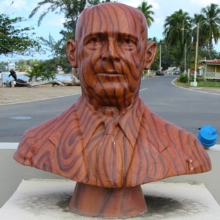
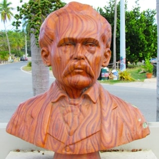
Busts of three historic figures
|
|
Busts of three historic figures
|
The three men honoured with busts at the corner of the Cross of Columbus Historic Sanctuary were all eminant figures in their own right. What they had in common and in relation to the monument, is their defense of the historic truth that Christopher Columbus discovered Puerto Rico during his second voyage in 1493 when he landed on the shores of what is now Aguada.
|
|
|
|
|
|
Don Cayetano Coll y Toste
|
|
Don Eugenio González
|
|
Don Salvador Brau
|
Plaques under the busts give a short description of each and explain why they are honoured here.
Cayetano Coll y Toste (1850-1930) was a medical doctor from Arecibo, also known as a writer and historian. He forcefully defended the fact that Columbus' landing place in Puerto Rico was on the beaches of Aguada.
Eugenio González (1886-1976) was a distinguished citizen of Aguada, a teacher, pharmacist, civic leader and politician. Author of the book, "The Historic Memory of Aguada", he defended the historic truth that the discovery of Puerto Rico happened on the beaches of Aguada.
Salvador Brau (1842-1912) was a native of Cabo Rojo and known as a dramatist, poet, historian and journalist. Author of the 1903 book, "History of Puerto Rico" and defender of the historic truth that Puerto Rico was discovered in the Aguada-Aguadilla Bay.
|
Other Views Around Aguada
In the Plaza
|
|
|
|
|
|
|
|
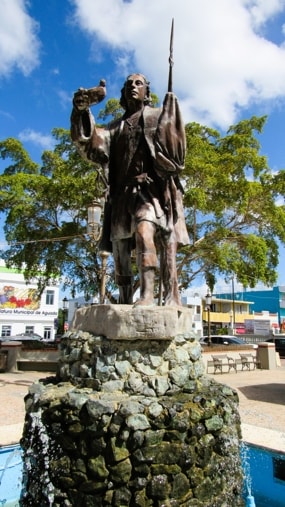
The statue of Christopher Columbus is located at the centre of Plaza Cristóbal Colón,.
|
|
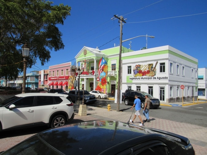
The Alcaldía and the Municipal Legislature's buildings in green and white, located next to one another on the Plaza and showing their decorations for Christmas.
|
|
|
|
|
|
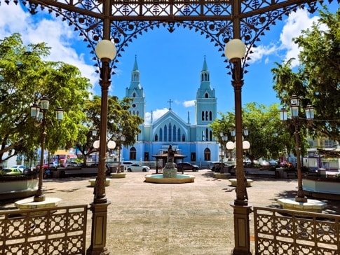
Looking across the Plaza from West to East, passed the statue of Christopher Columbus to the parish church.
|
|
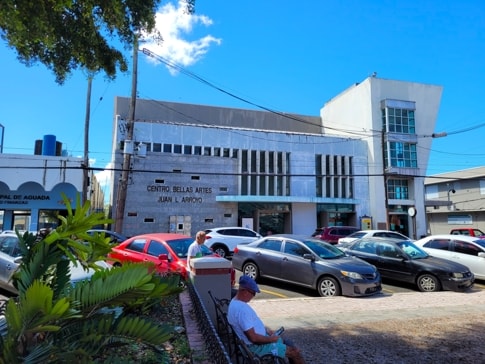
Centro de Bellas Artes, Juan L Arroyo (Fines Arts Centre), at the southwestern corner of Plaza Cristóbal Colón.
|
|
|
|
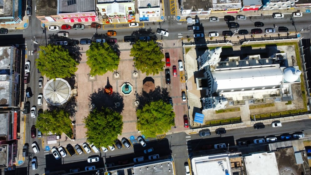
An aerial view of Plaza Cristóbal Colón with the parish church of Saint Francis of Assisi on the eastern side to the right. The Alcaldía is at the top, above the statue of Christopher Columbus.
|
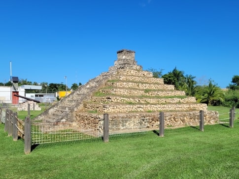
The Aguada Pyramid
|
|
Piramide de Aguada
|
A Mayan style pyramid, built by Aguada resident Nelson Ruiz on his property, after a trip to Chichén Itzá in Mexico.
|
|
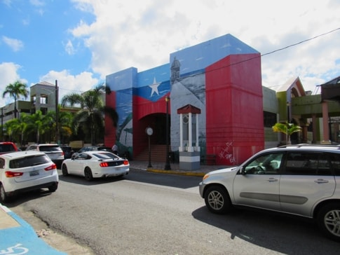
Bandera de Hector
|
|
Bandera de Hector
|
On Calle Colón, the Bandera de Hector completely covers the entrance to the old public car terminal.
|
Plaza del Mercado
The Aguada Marketplace (Plaza del Mercado).
|
|
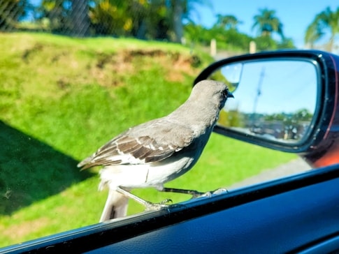
Driving through barrio Atalaya
An inquisitive local checking things out.
|
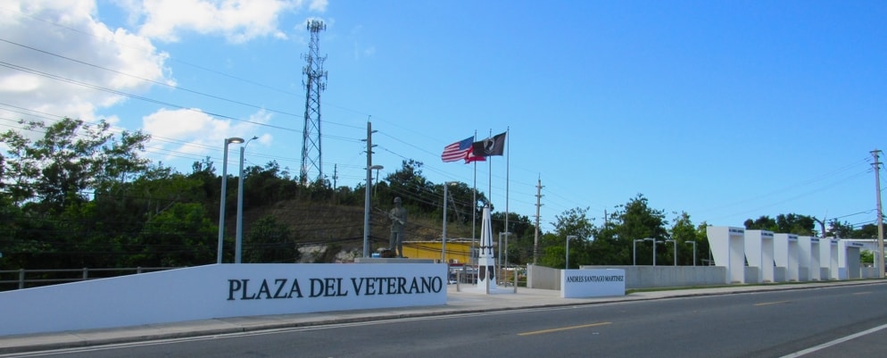
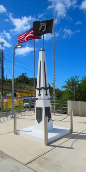
Plaza del Veterano
|
|
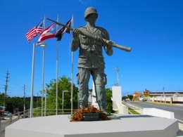
Monument to the Soldiers of Aguada
|
|
|
Situated opposite the Municipal Cemetery, in the triangular space formed between Carretera Naranjos and Avenida Nativo Alers roads, is Plaza del Veterano (Veteran's Plaza).
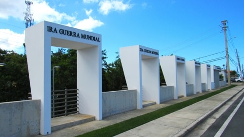
Dedicated to all members of the armed forces from Aguada who have served in conflicts since World War I.
Located within the Plaza is the "Monument to the Soldier", which honours those from Aguada who died in various wars. One of the plaques on the monument carries the names of the fallen.
|
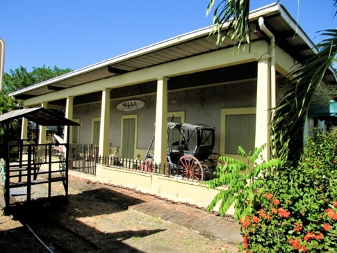
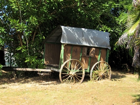
The Aguada Agricultural Museum
|
|
|
|
|
What was once the Aguada railway station, has been converted into the small Museo Agricola Aguada (Aguada Agricultural Museum).
|
|
|
|